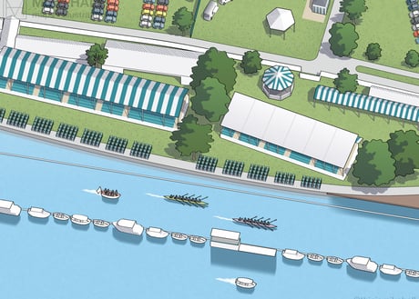
Queen Elizabeth Olympic Park Map
Client: London Legacy Development Corporation/Embrace | June 2015 | Adobe Illustrator
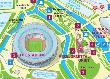
In 2015 was commissioned to design the official visitor map for the Queen Elizabeth Olympic Park in east London after it had fully reopened to the public following the London 2012 Olympics. The map was displayed at entrances around the park and was available to the public in printed pamphlet form and to download from the official website. The client wished for a detailed, clear and easily navigable design, showing all the main venues and landmarks within the park (including the Stadium, Copper Box and Aquatics Centre) drawn in axonometric detail, and with entrances, facilities and surrounding features clearly marked.
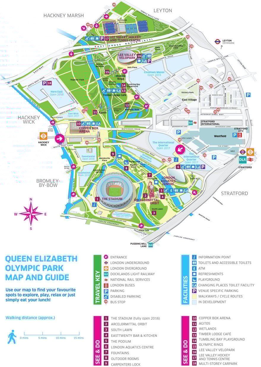
The full design including the symbol and number key. All symbols, numbers and text labels on the map were placed by the commissioning design agency.
Closer detail of the southern section of the map.
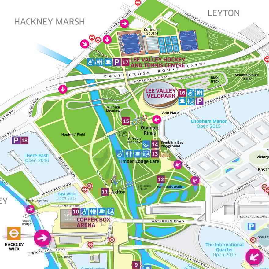
Closer detail of the northern section of the map.
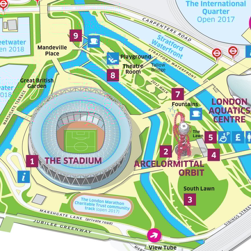
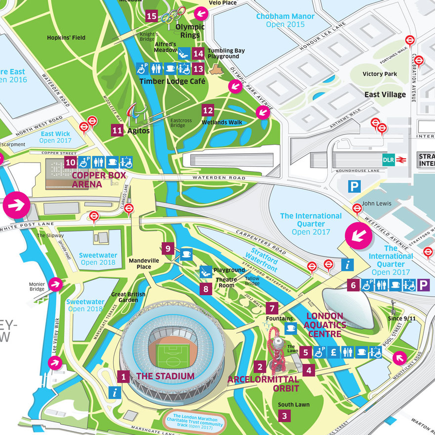
Closer detail of the area around the Olympic Stadium and the ArcelorMittal Orbit.
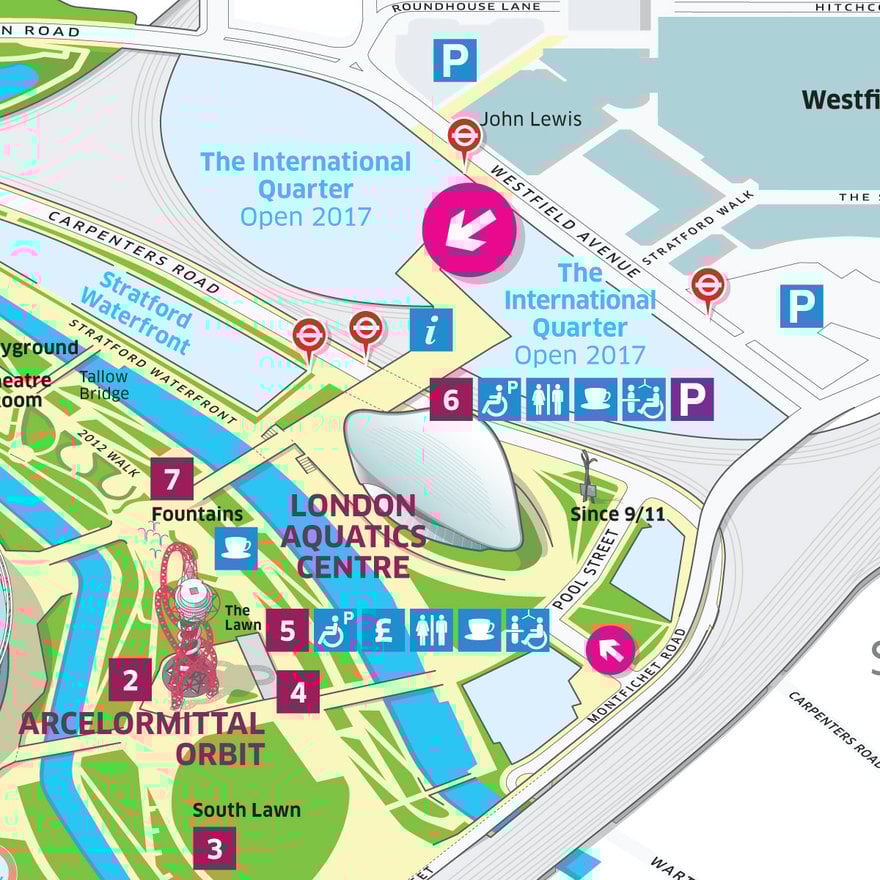
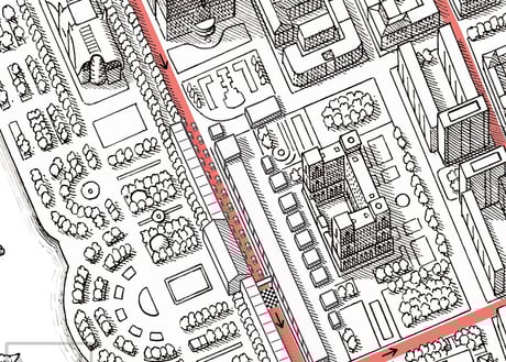
Closer detail of the area around the Aquatics Centre and the main park entrance beside The International Quarter.
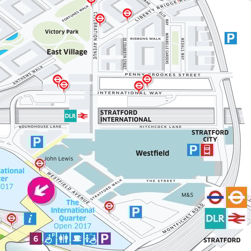
Closer detail of the area to the east of the park, including Westfield shopping centre, Stratford International station and the East Village.
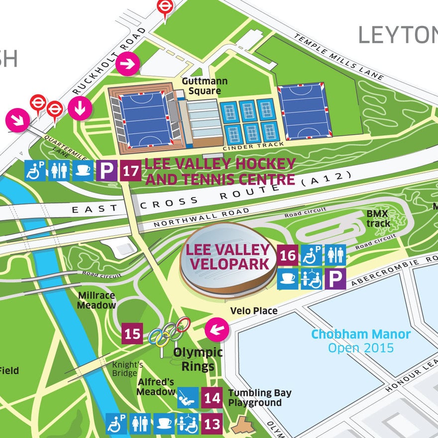
Closer detail of the area around the Velodrome and Lee Valley Hockey and Tennis Centre.
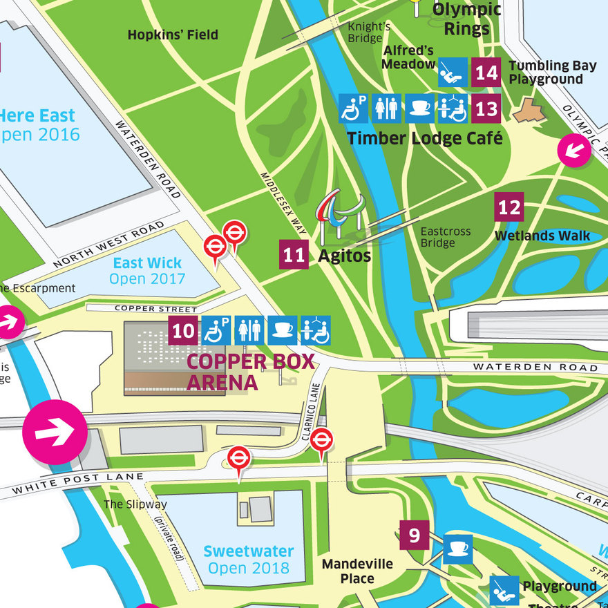
Closer detail of the area around the Copper Box Arena at the centre of the map.

Step-by-step showing the development of the ArcelorMittal Orbit drawing using Adobe Illustrator.