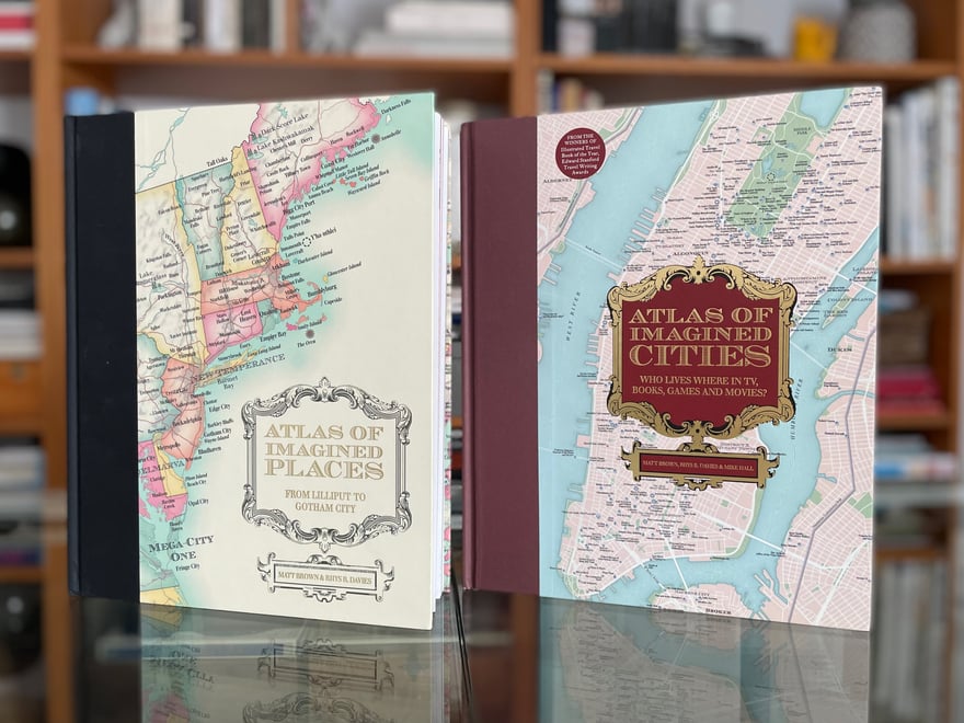
Atlases of the Imagination
Client: Batsford Books | 2020-2022 | Adobe Illustrator and Photoshop
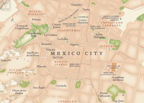
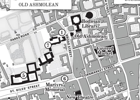
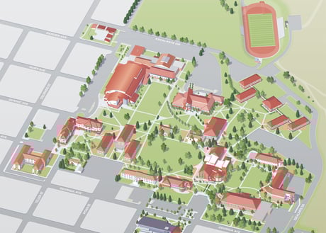
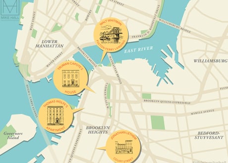
Atlas of Imagined Places (2021) and its sequel Atlas of Imagined Cities (2023), both written and researched by Matt Brown and Rhys B. Davies and published by Batsford Books, bring together thousands of fictional locations set in the real world from sources including movies, TV shows, literature, poetry, comics, myths, video games and much more. I was commissioned to create a series of eighteen detailed, period style maps for each title that plot the locations of all the places accompanied by colourful illustrations of various characters and scenes.
🏆 The Atlas of Imagined Places was the winner of the Illustrated Travel Book of Year prize at the 2022 Edward Stanford Travel Writing Awards, and was Highly Commended at the 2022 British Cartographic Society Awards.
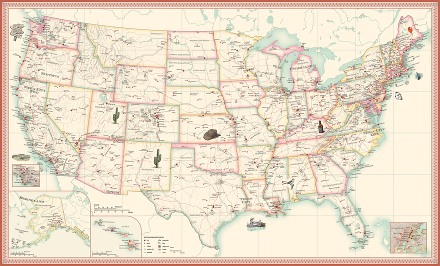
The full design for the map of the United States in Atlas of Imagined Places, which is divided into three sections (east, central and west) for the book.
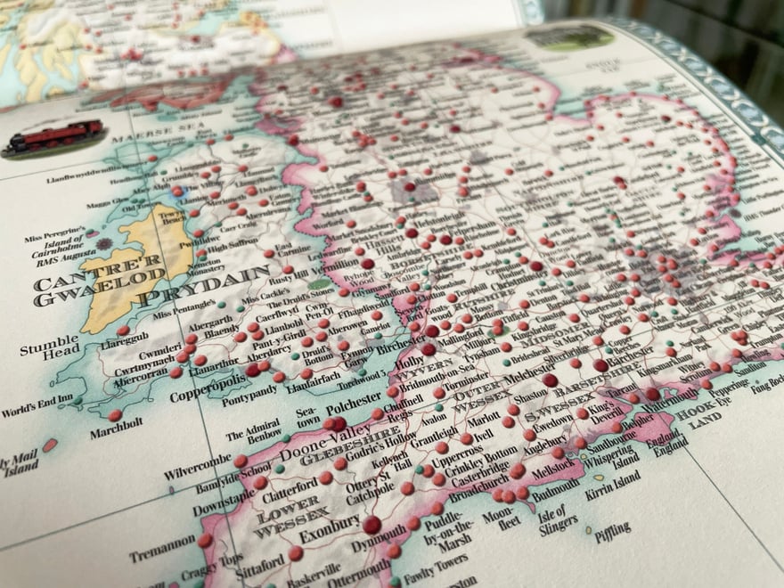
Detail from the map of Britain and Ireland in Atlas of Imagined Places, the most densely packed of all the maps in this title.
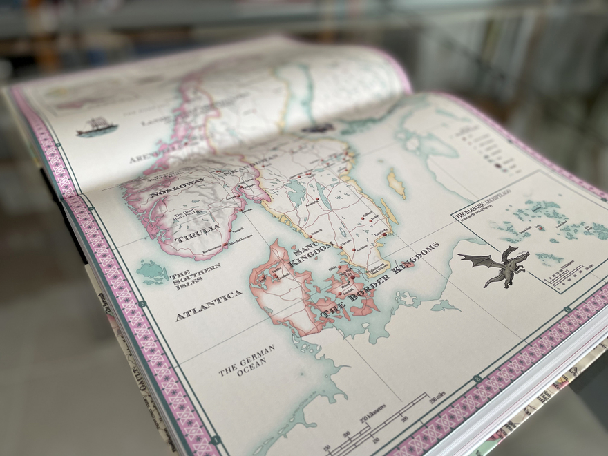
The map of the Nordic Countries, including Scandinavia, Finland and Iceland from Atlas of Imagined Places. This map includes locations from two animated movie franchises: the kingdom of Arendelle from Disney's Frozen and the Barbaric Archipelago from How To Train Your Dragon.
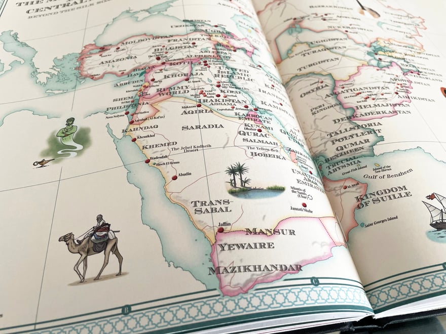
Detail from the map of the Middle East and Central Asia from Atlas of Imagined Places.
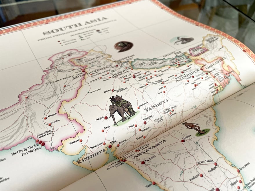
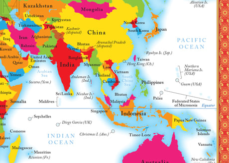
Detail of the map of the Indian Subcontinent from Atlas of Imagined Places.
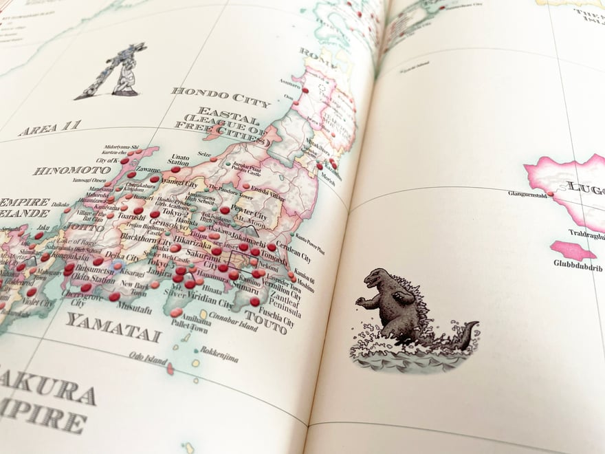
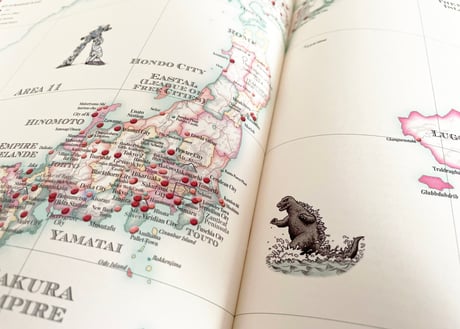
Detail from the map of Japan from Atlas of Imagined Places, one of my favourite maps to draw. Here can be seen an illustration of the monster Godzilla (or Gojira), emerging from the sea to attack Tokyo.
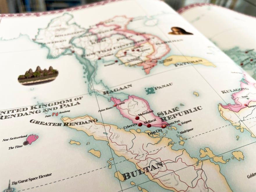
Detail from the map of south east Asia from Atlas of Imagined Places.
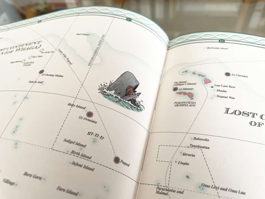
Detail from the map of the Pacific Ocean from Atlas of Imagined Places, showing the illustration of a scene from Moby-Dick depicting the whale attacking the crew of the Pequod.
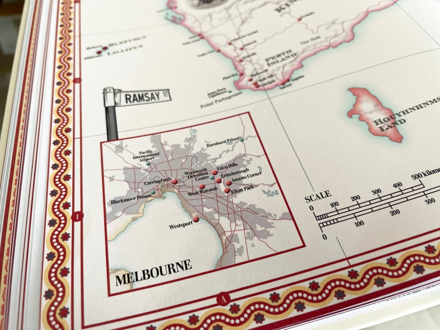
Several maps in Atlas of Imagined Places include details of large cities, such as this map of Melbourne set in the corner of the map of Australia and New Zealand.
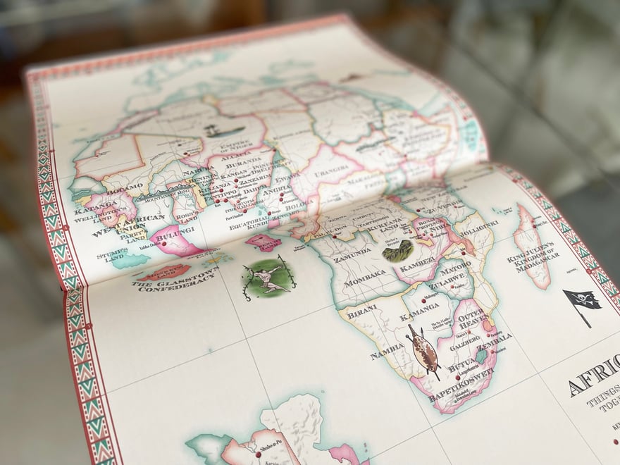
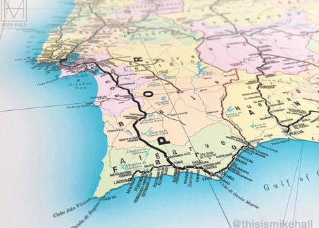
The map of Africa from Atlas of Imagined Places, one of several that depict entire continents.
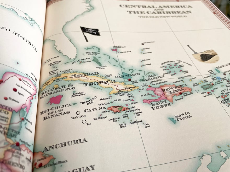
Detail from the map of Central America and the Caribbean from Atlas of Imagined Places, which features many small fictional islands alongside the real ones.
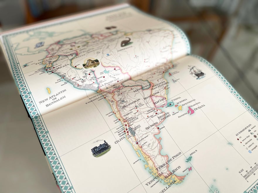
The map of South America from Atlas of Imagined Places.
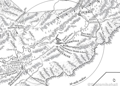
All of the maps were initially developed using Adobe Illustrator, with mountain terrain created using effects in Photoshop.
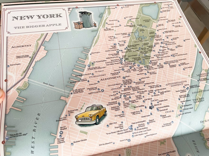
Detail of the map of New York from Atlas of Imagined Cities. Other cities featured in the title are Washington DC, Los Angeles, Miami, Chicago, San Francisco, New Orleans, Paris, Berlin, London, Venice, Sydney, Rio de Janeiro and Tokyo.
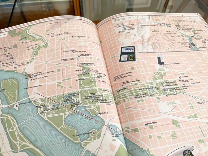
Detail of the map of Washington, DC from Atlas of Imagined Cities. Many locations in this map relate to both real and fictional federal and governmental buildings in the city.
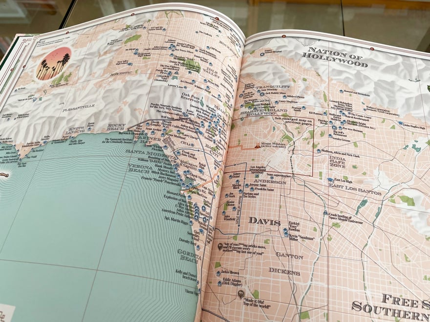
Detail of the first of two maps of Los Angeles from Atlas of Imagined Cities. This map includes the route of the lava flow from the movie Volcano and the route of the runaway bus from the movie Speed.
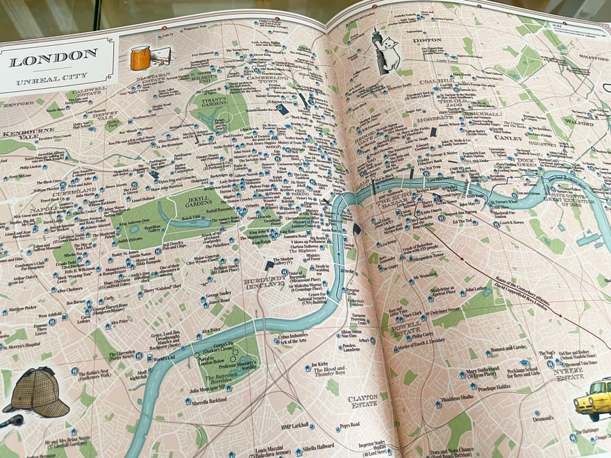
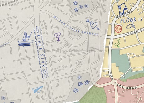
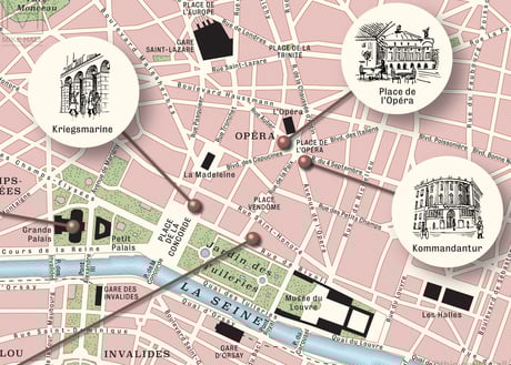
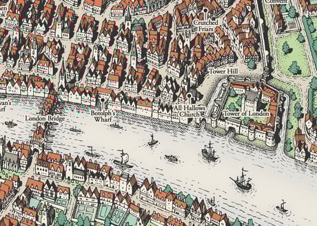
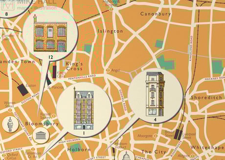
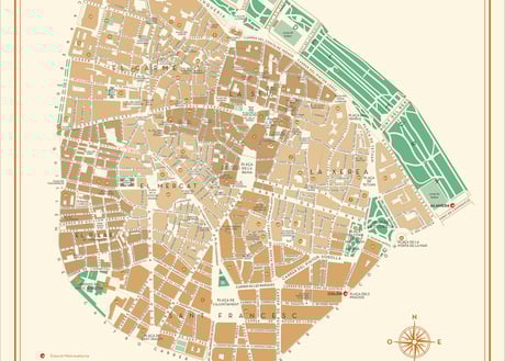
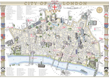
Detail of the map of central London from Atlas of Imagined Cities. London was one of several cities that required two maps, one to show the densely-packed central area and the second to show the wider metropolitan area.
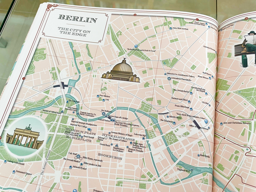
Detail of the map of Berlin from Atlas of Imagined Cities.
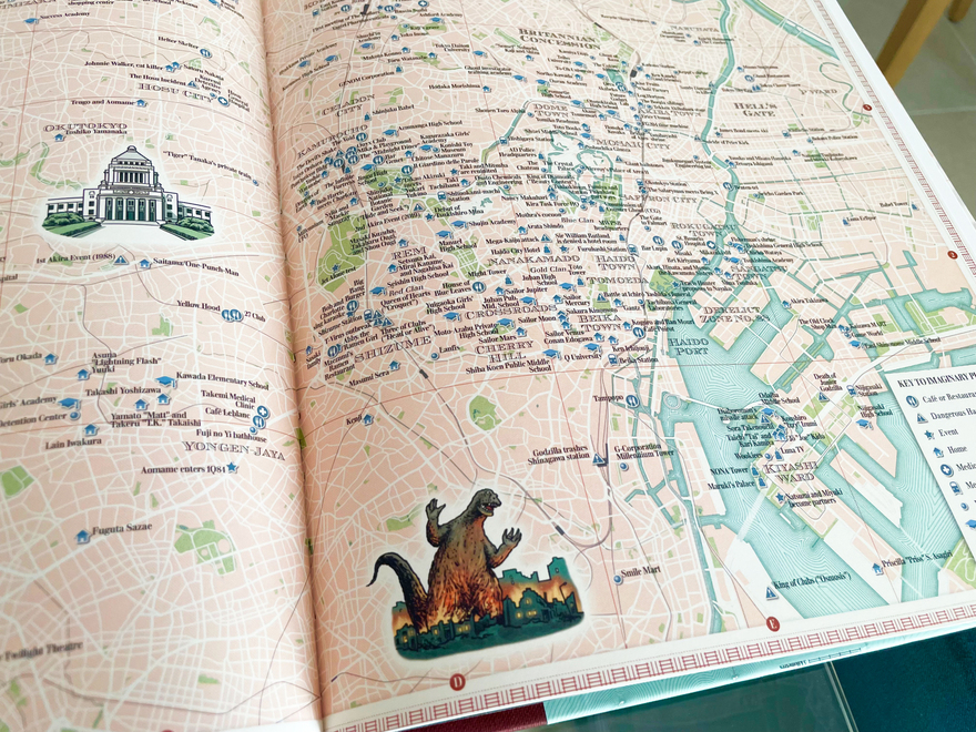
Detail of the map of central Tokyo from Atlas of Imagined Cities, in which Godzilla makes a reappearance, laying waste to the city.