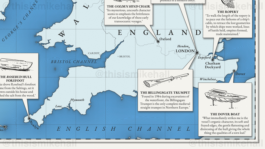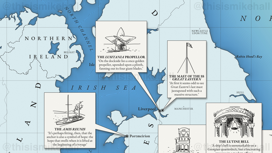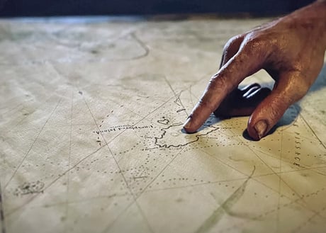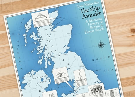
The Ship Asunder
Client: Penguin Books | January-March 2022 | Adobe Illustrator with handdrawn elements
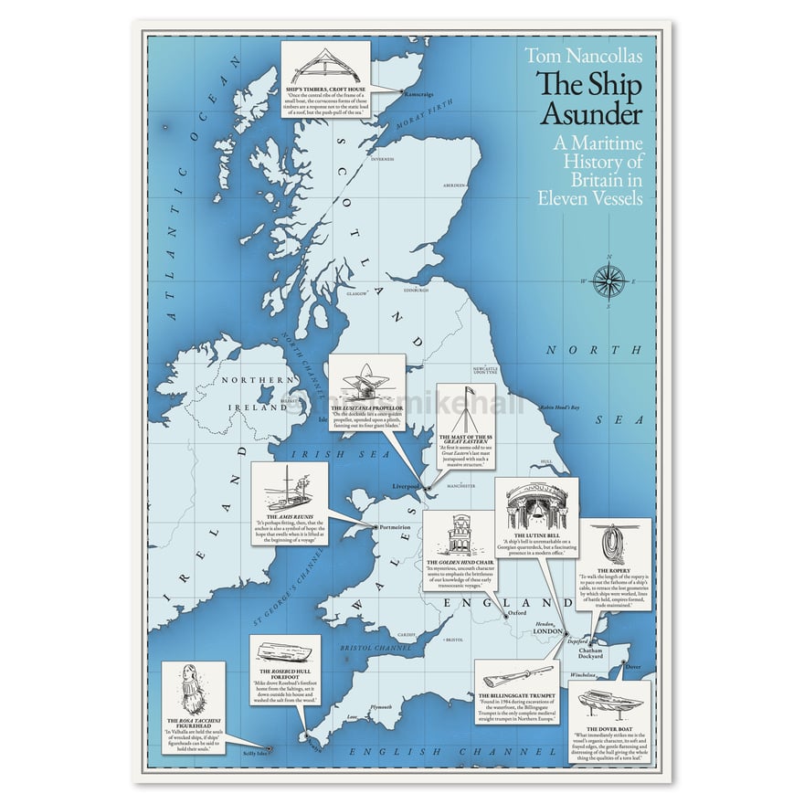
This illustrated map of Britain was commissioned by Penguin Books to celebrate the publication of The Ship Asunder: A Maritime History of Britain in Eleven Vessels (Particular Books, 2022) by Tom Nancollas. The map displays the locations of eleven artefacts from Britain's maritime history, each represented by a small illustration accompanied by a short text extracted from the book. These illustrations also appear on the reverse side with extended excerpts.
In keeping with the maritime theme, the map was designed to resemble an antique nautical chart, using shades of blue and a period style serif typeface to match the book's front cover artwork. The map was made available as a fold-out leaflet from Waterstones bookshops.

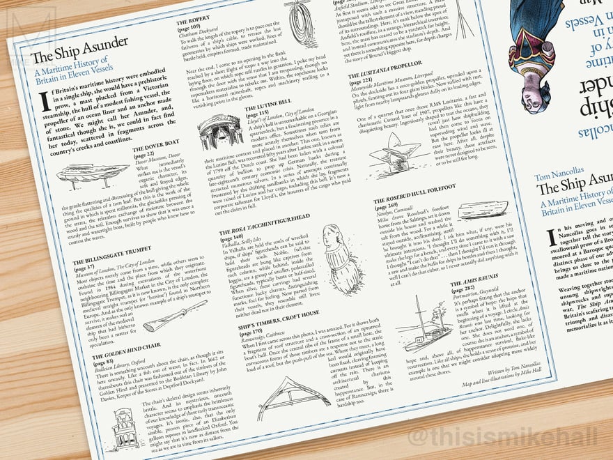
The rear side of the fold-out leaflet, with excerpts from the book.