
Atlas of Imagined Places
🏆 WINNER of the Illustrated Travel Book of the Year category, Edward Stanford Travel Writing Awards 2022
⭐️ HIGHLY COMMENDED, British Cartographic Society Awards 2022
Client: Batsford Books | January 2020-March 2021 | Adobe Illustrator and Photoshop
The Atlas of Imagined Places: From Liliput to Gotham City (Batsford, 2021), researched and written by Matt Brown and Rhys B. Davies, compiles thousands of fictional and imaginary locations set in the real world from film, television, literature, myths, comics, computer games and many other historical and modern sources. I was commissioned to create a series of eighteen detailed maps in an antique style to plot the locations of all these fictional places, each focussing on a different part of the world in the manner of an atlas.

The cover design uses an edited detail from the map of the east coast of the United States.
I was originally approached by Matt Brown to create maps for this book in early 2020. Matt has been a great supporter of my work over the years and has written regularly about my map designs for Londonist.

Detail of the title page. Chapter headings and passages of text are embellished with black and white illustrations from another source.

An example of a 19th century map print, the style of which the publisher wished to emulate in the maps in this book.
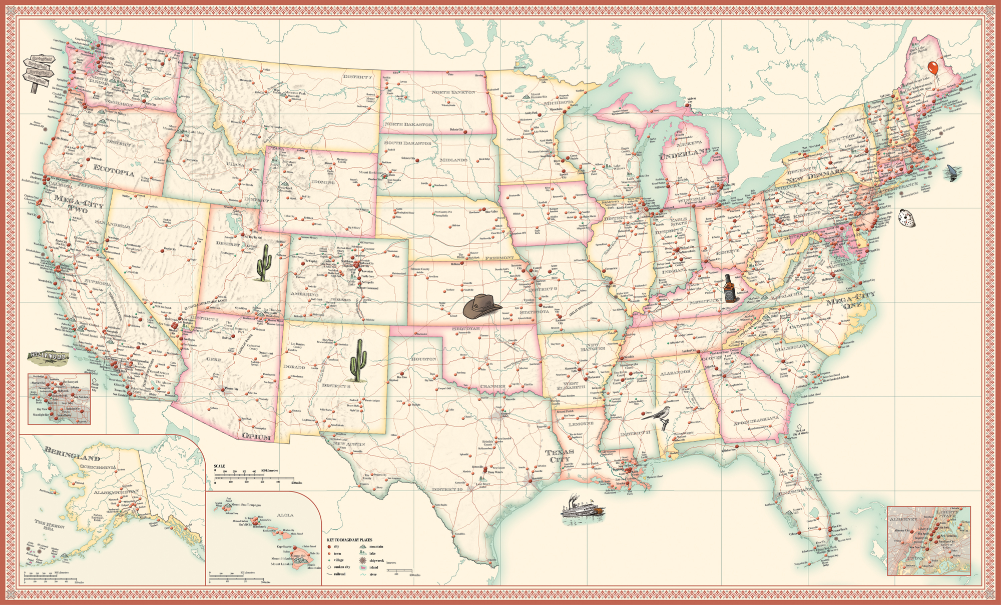
The full design for the map of the United States, which is divided into three sections (east, central and west) for the book. This was the first map to be completed and was used for early promotion of the book.
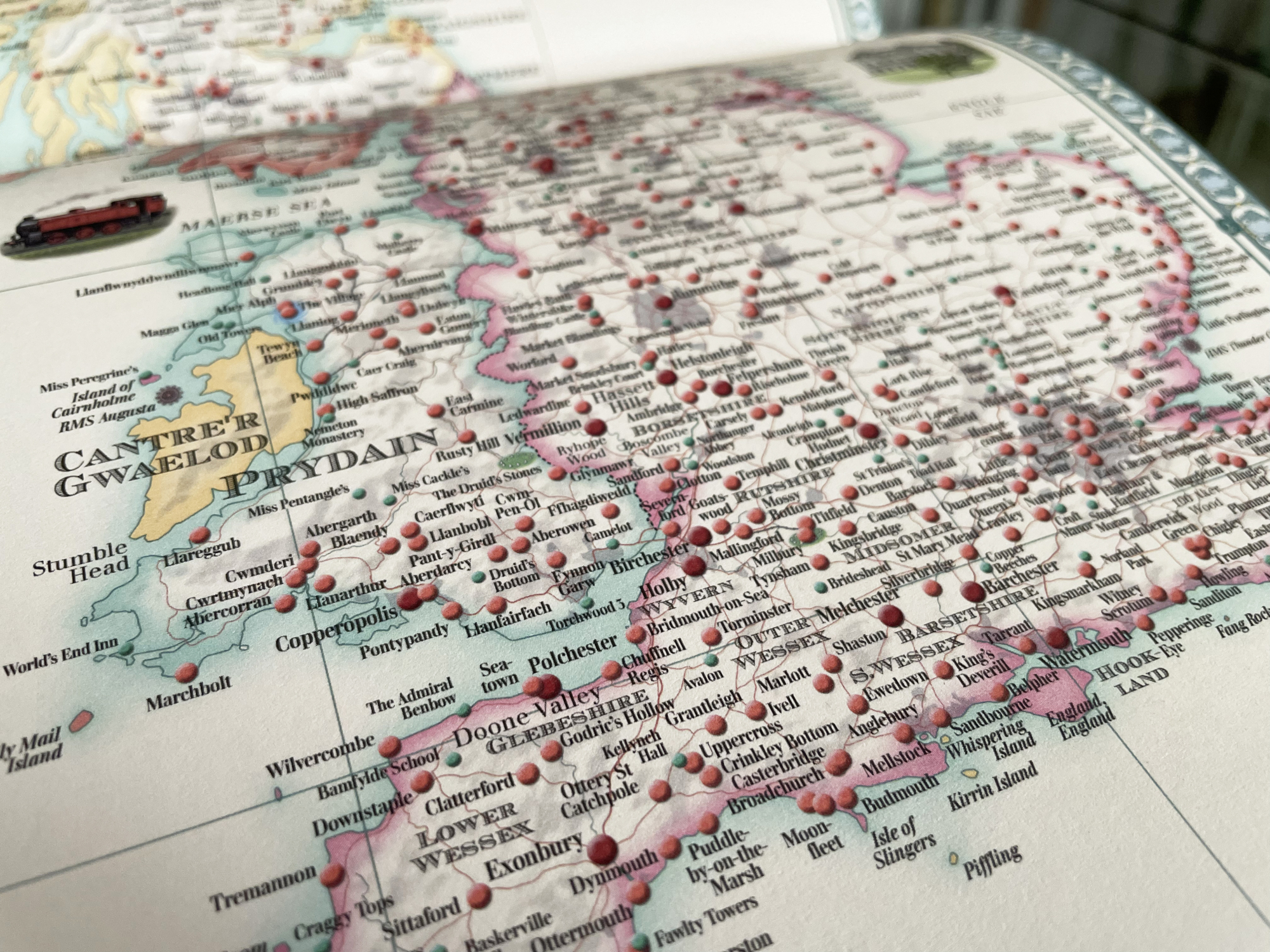
Detail from the map of Britain and Ireland, the most densely packed of all the maps.
Matt Brown's idea for the book was directly inspired by a similar map of fictional places in Britain that he created for Londonist.
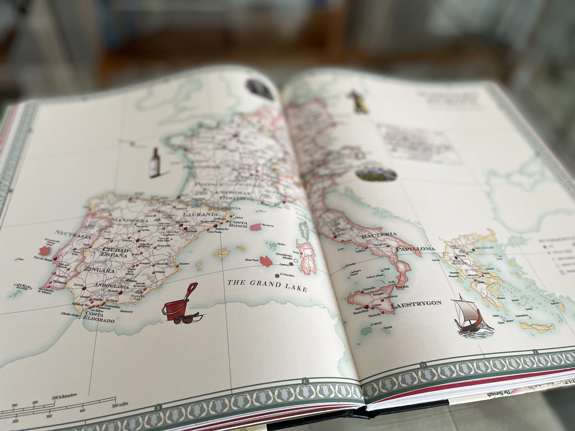
The map of Western Europe, including Greece and Cyprus.
The process of designing the maps was a collaborative one. Each map began as a rough draft by Matt which included detailed instructions for locations of fictional islands, coastlines and other geographical features. These were then developed by me into more detailed, stylised maps, which were then sent back to Matt who placed all of the text labels and pins.
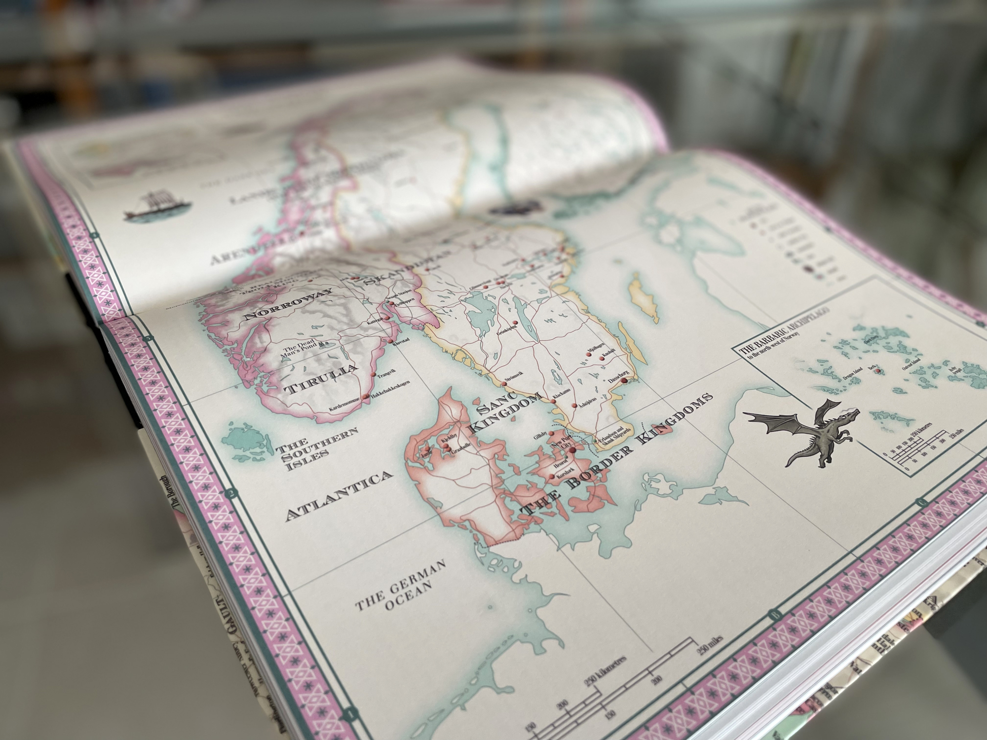
The map of the Nordic Countries, including Scandinavia, Finland and Iceland. This map includes locations from two animated movie franchises: the kingdom of Arendelle from Disney's Frozen and the Barbaric Archipelago from How To Train Your Dragon.
Each map is enlivened by small colour illustrations, depicting characters and scenes from various sources featured on each map. I also developed a range of icons and symbols for features such as mountains, lakes, shipwrecks and even 'sky elevators'.
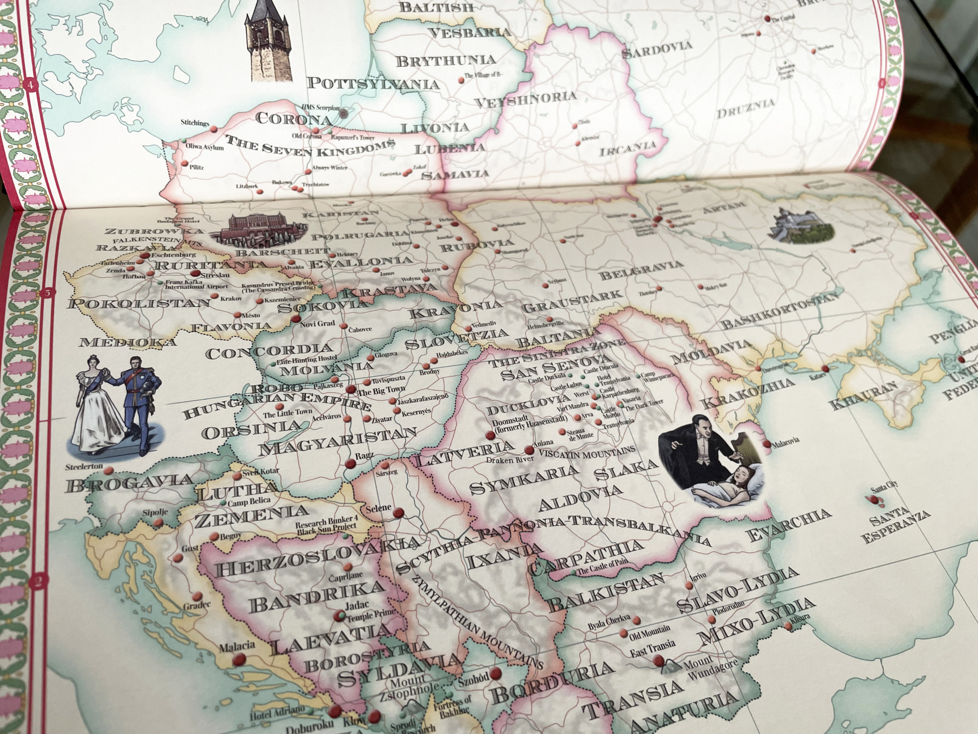
Detail from the map of Eastern Europe, including a large section of European Russia and the Baltics. Here can be seen illustrations depicting Dracula, a scene from The Prisoner of Zenda, the Grand Budapest Hotel from the Wes Anderson film of the same name, and Rapunzel's tower.
The decision was taken to show the borders of real-life countries, though without actually labelling any of them. Instead, labels set in an open serif typeface mark the rough locations of fictional countries and empires.
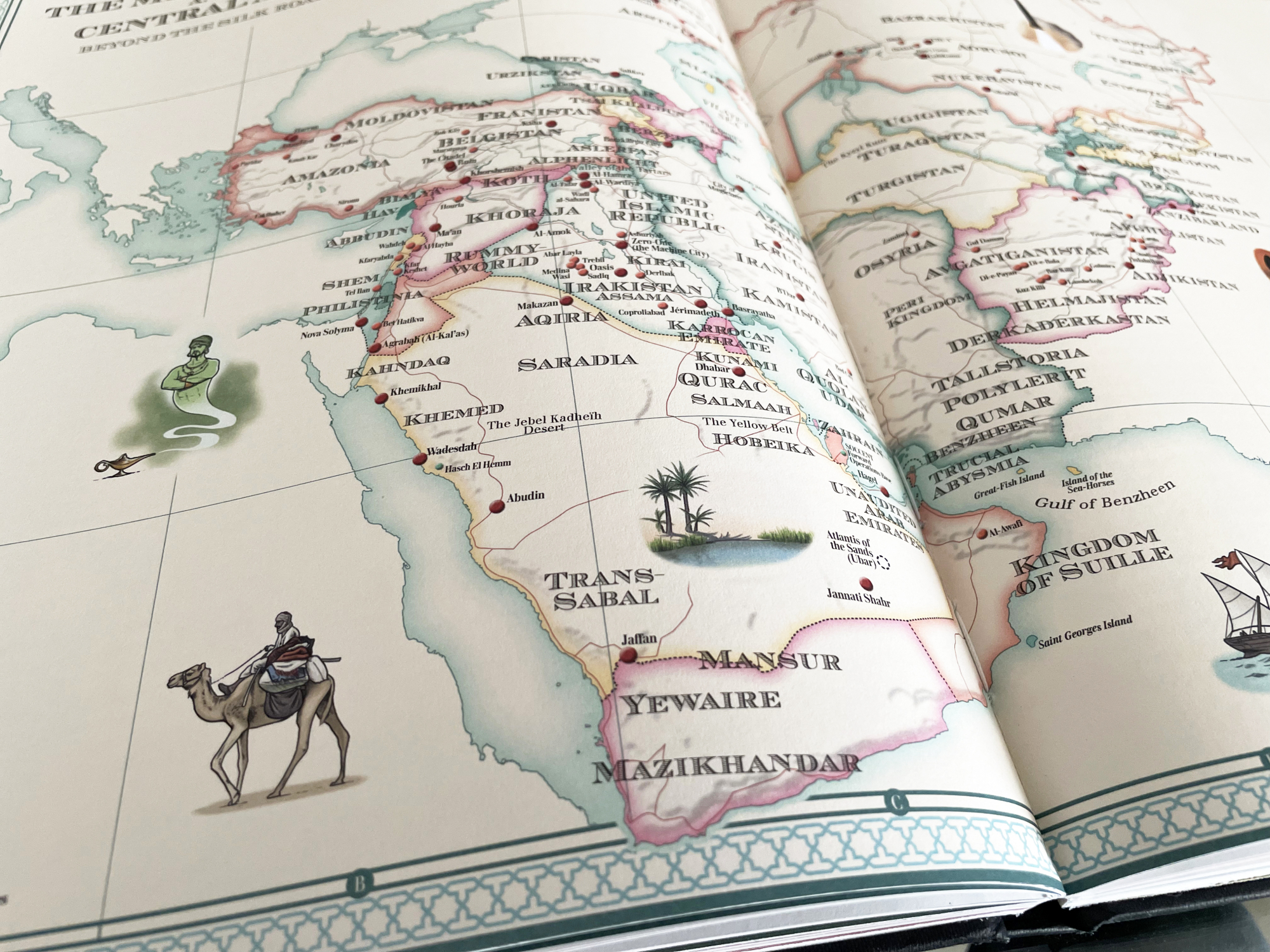
Detail from the map of the Middle East and Central Asia. This was one of the more challenging maps to design, in that there are no precedents for maps of both regions together on the same projection (besides maps of the whole world or the continent of Asia).
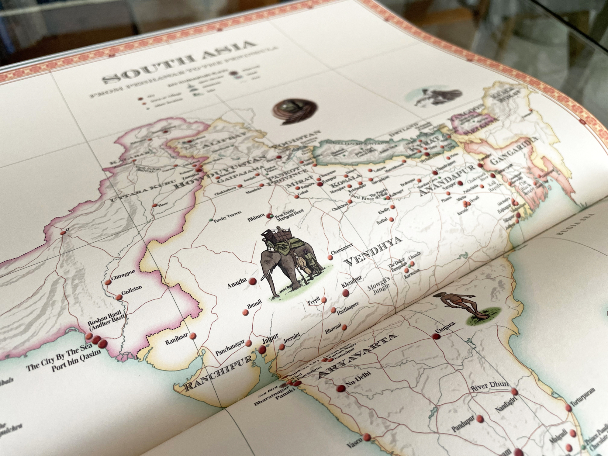
Detail of the Indian Subcontinent.
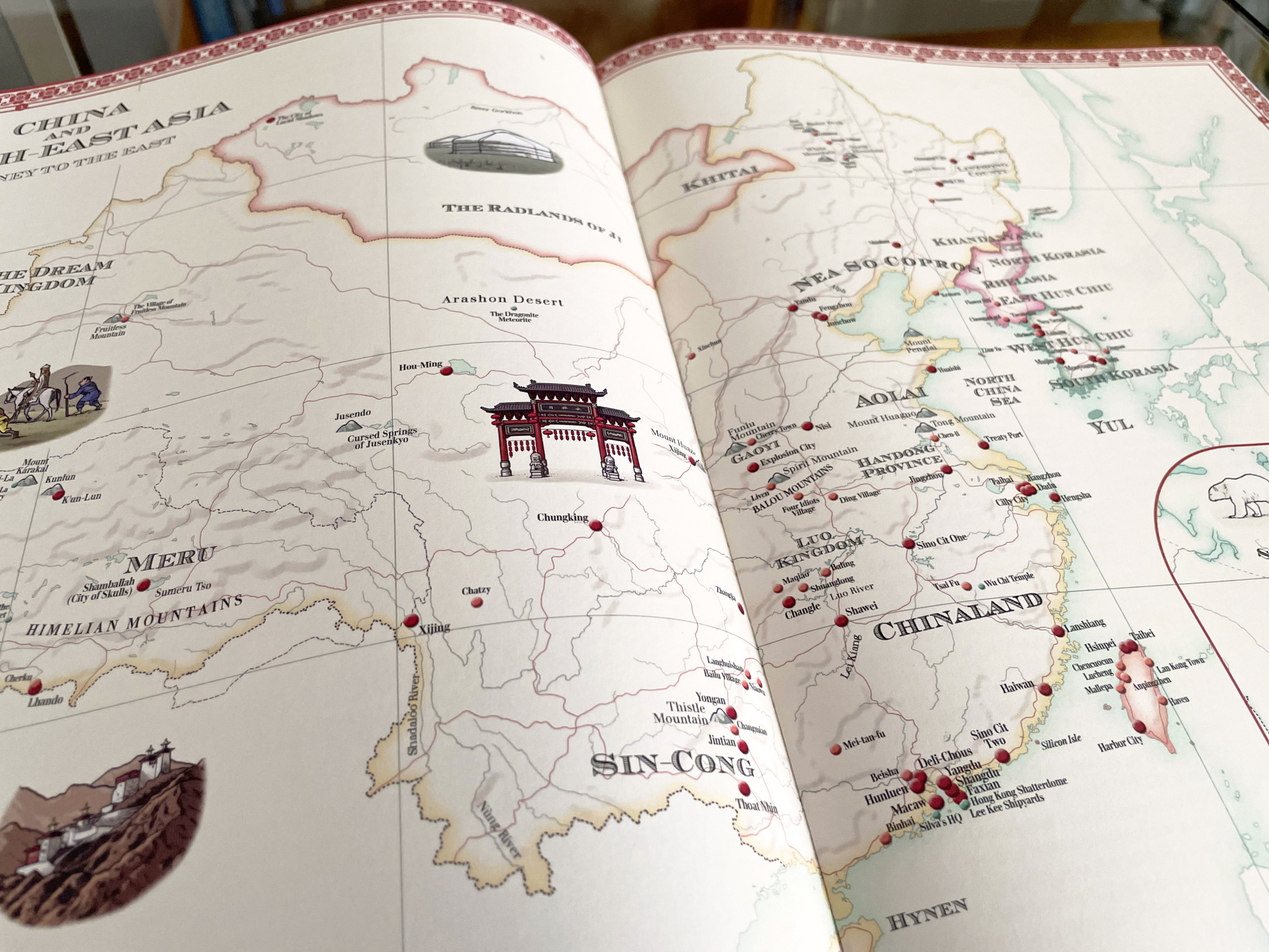
Detail of China, Mongolia and the Far East. This map also presented a challenge, in that it depicts a large area with relatively few fictional locations compared to other maps.
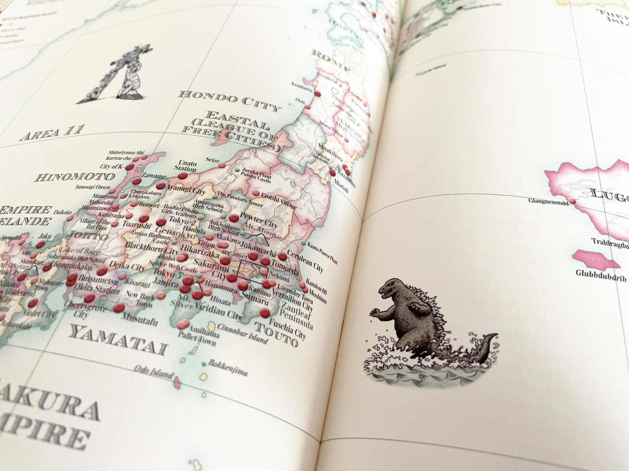
Detail from the map of Japan, one of my favourite maps to draw. Here can be seen an illustration of the monster Godzilla (or Gojira), emerging from the sea to attack Tokyo.
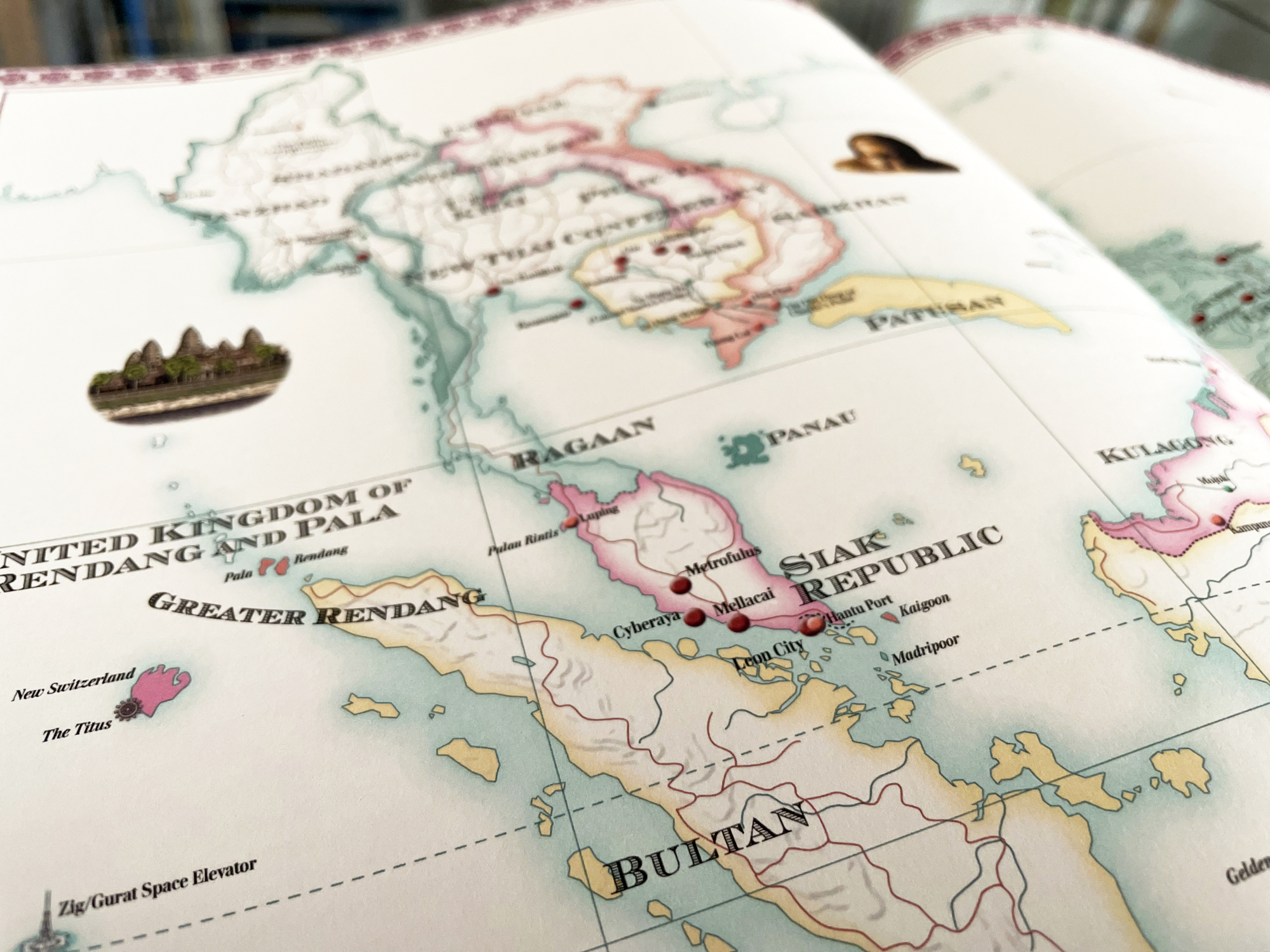
Detail from the map of south east Asia.
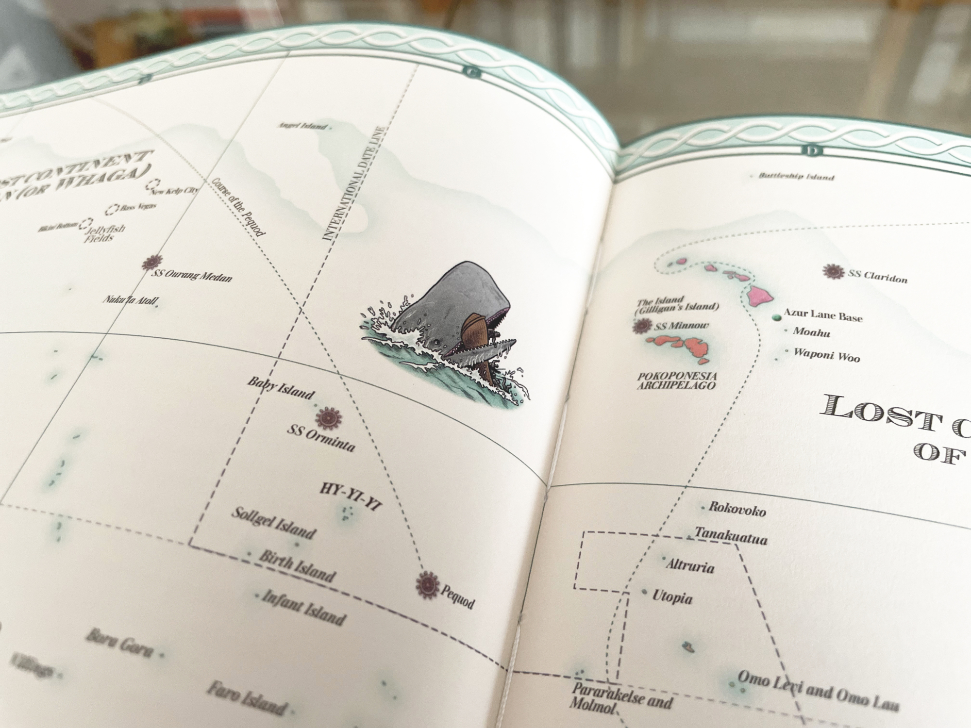
Detail from the map of the Pacific Ocean, showing the illustration of a scene from Moby-Dick depicting the whale attacking the crew of the Pequod.
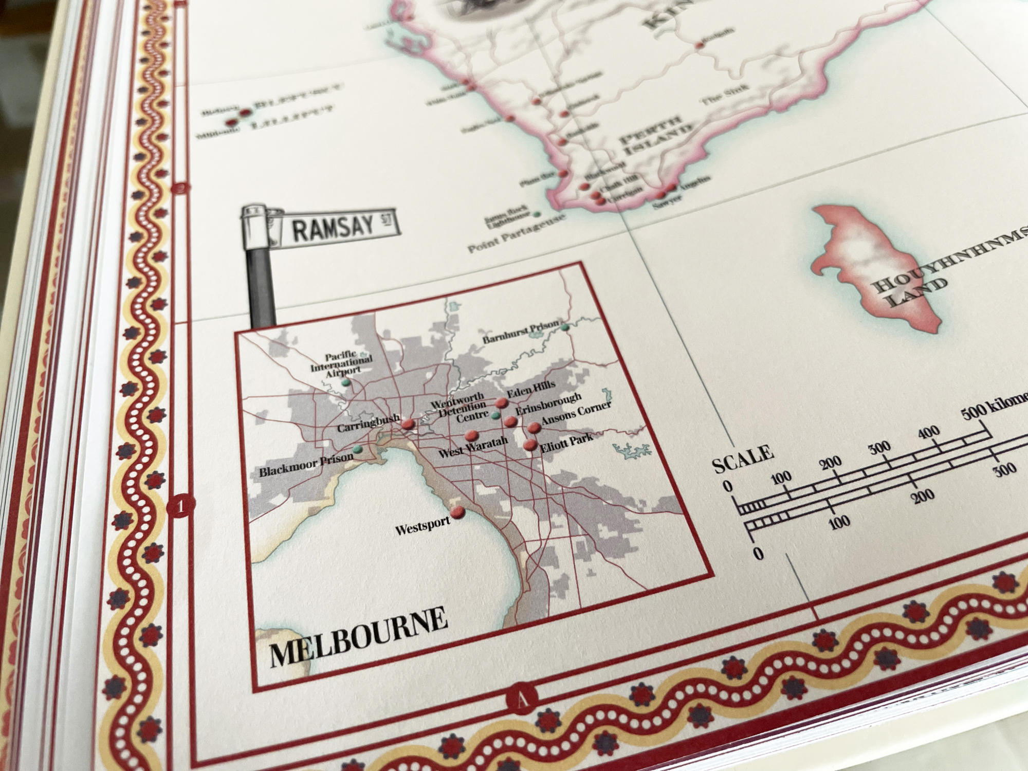
Several maps include inset maps that zoom in on large cities with many fictional locations within them, such as this map of Melbourne set in the corner of the map of Australia and New Zealand.
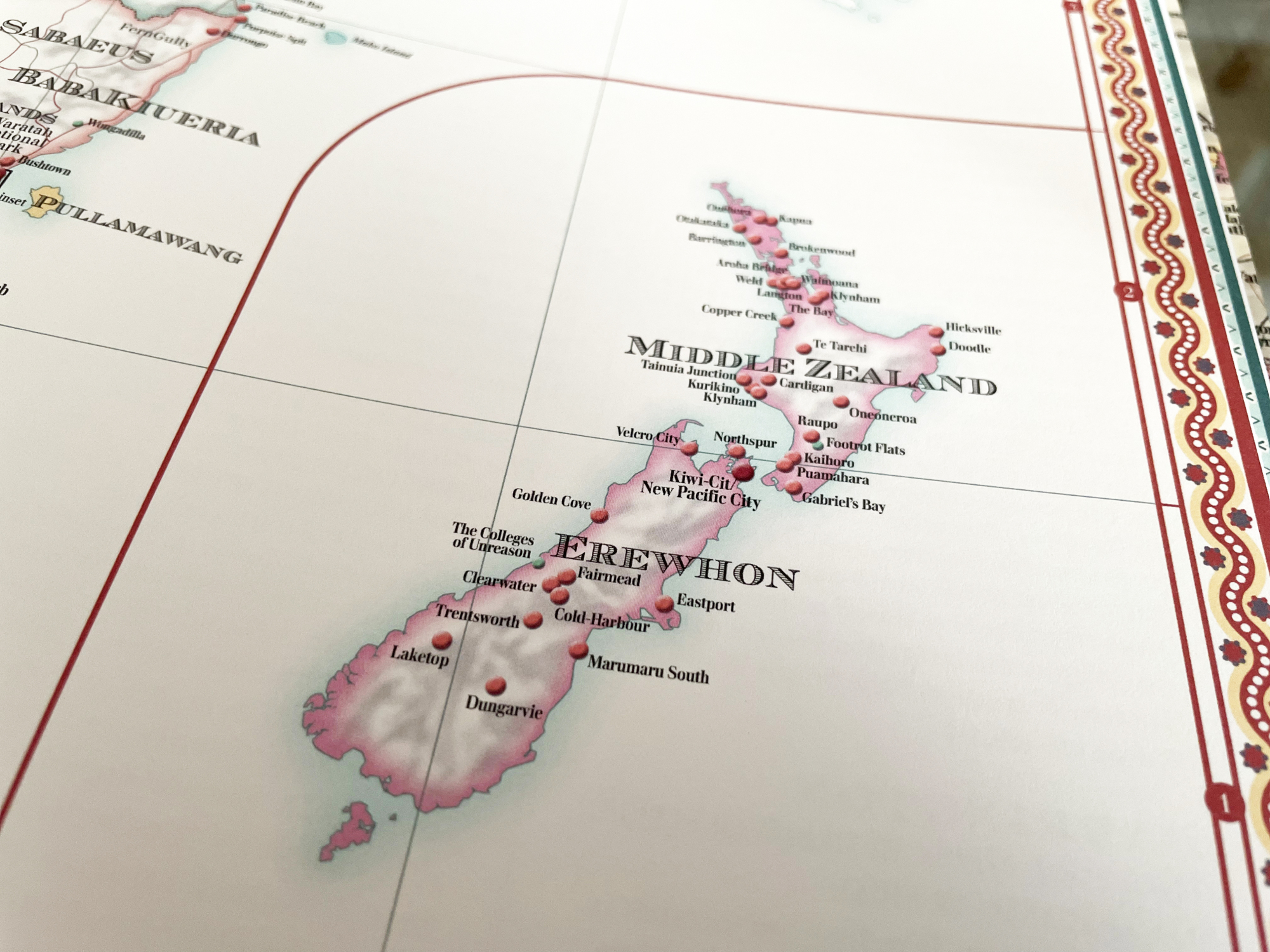
Australia and New Zealand appear together on the same map; in order to solve the problem of the distance between both landmasses and avoid showing the wide sea between them, New Zealand is contained within a box at the same scale.
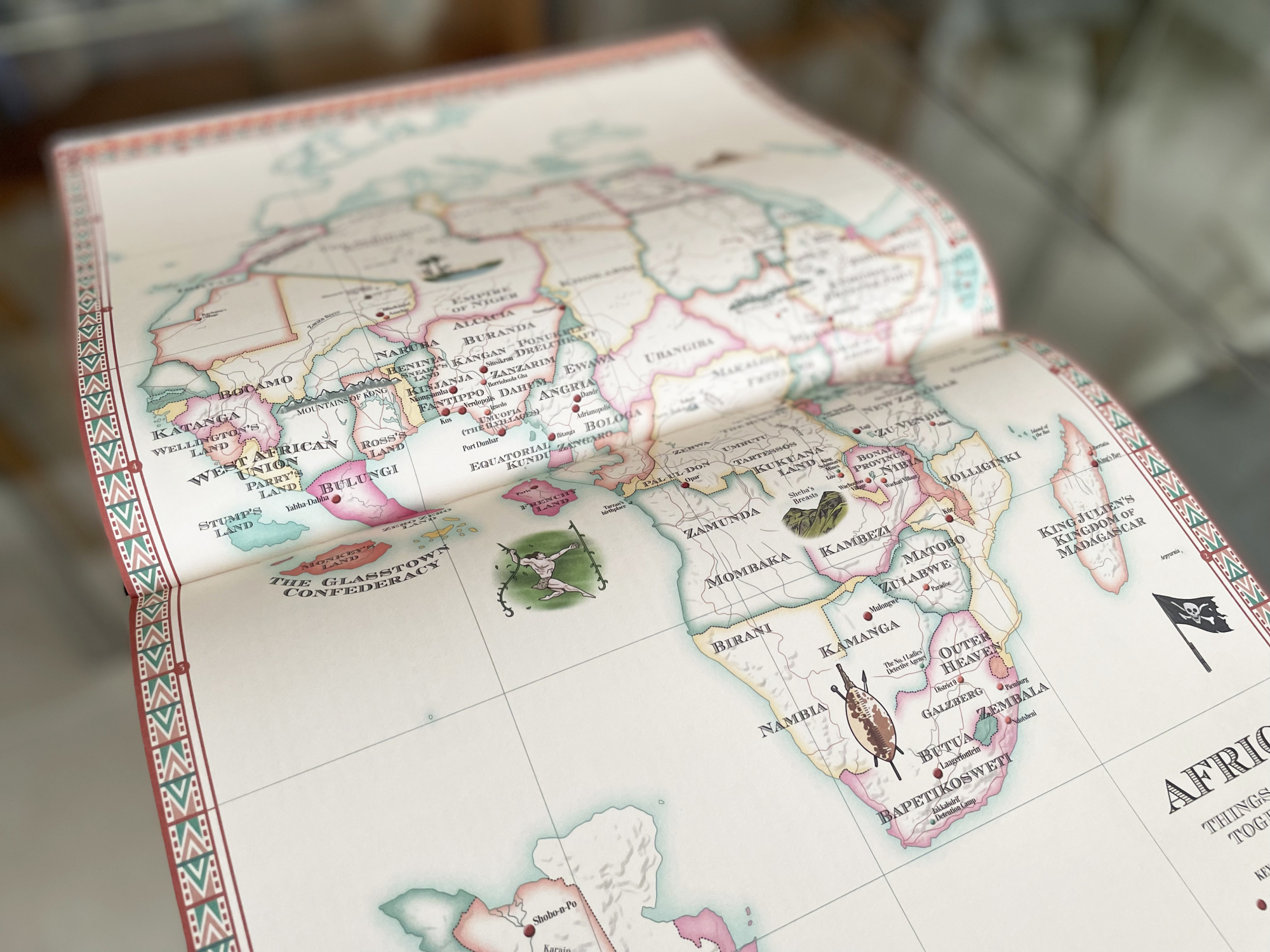
The map of Africa, one of several that depict entire continents.
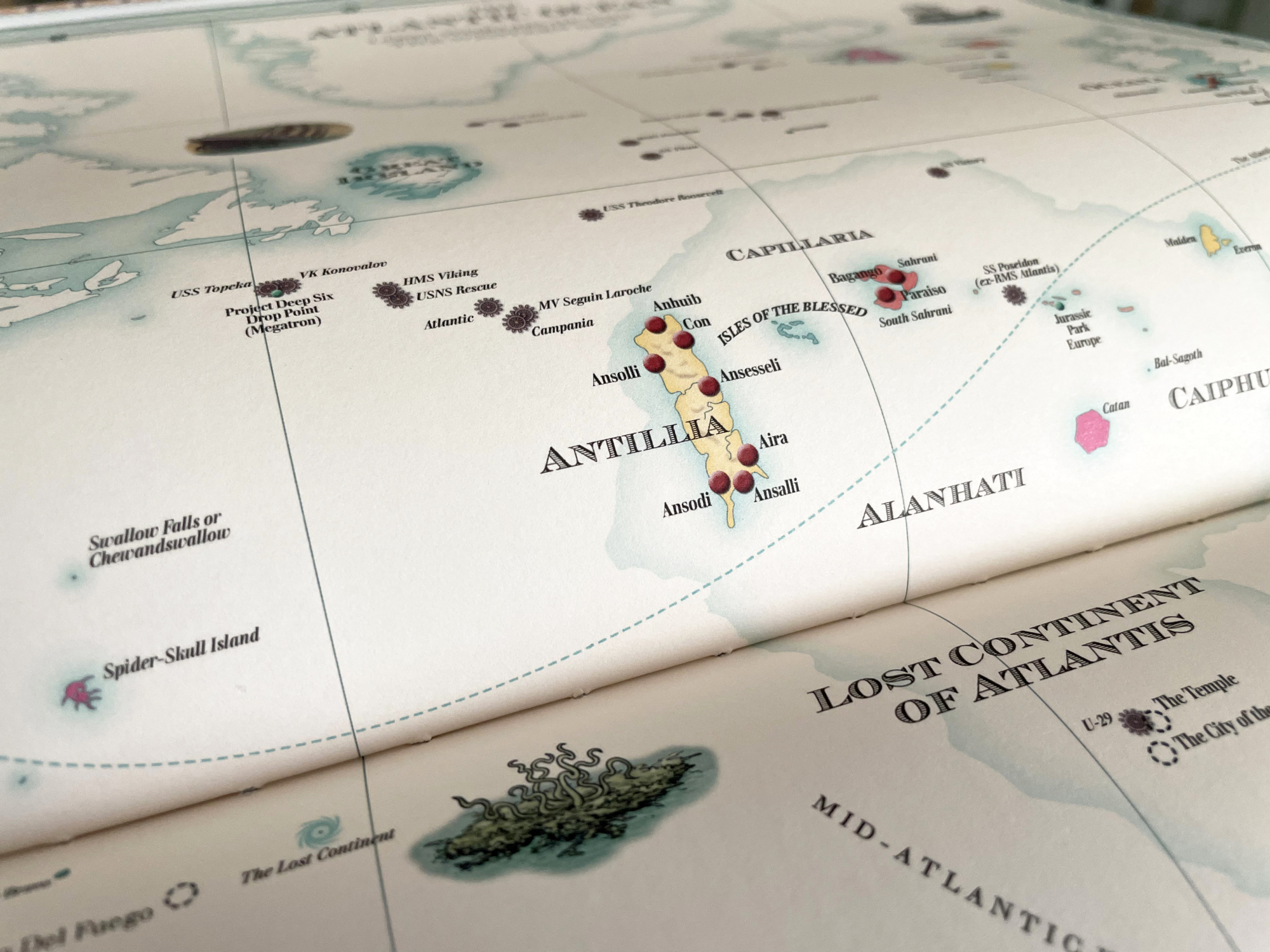
Detail from the map of the Atlantic Ocean, one of two maps dedicated entirely to oceans. Here can be seen Antillia, a phantom island reputed to exist in the 15th century and which was depicted on several maps at the time.
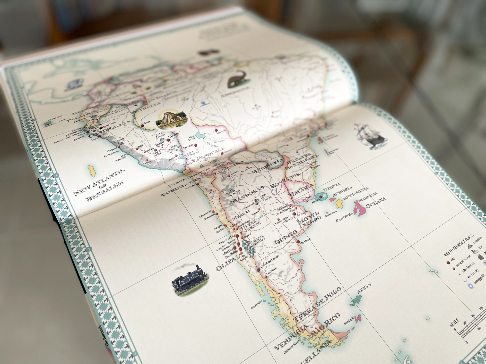
The map of South America.
All of the maps were initially developed using Adobe Illustrator, with mountain terrain created using effects in Photoshop.
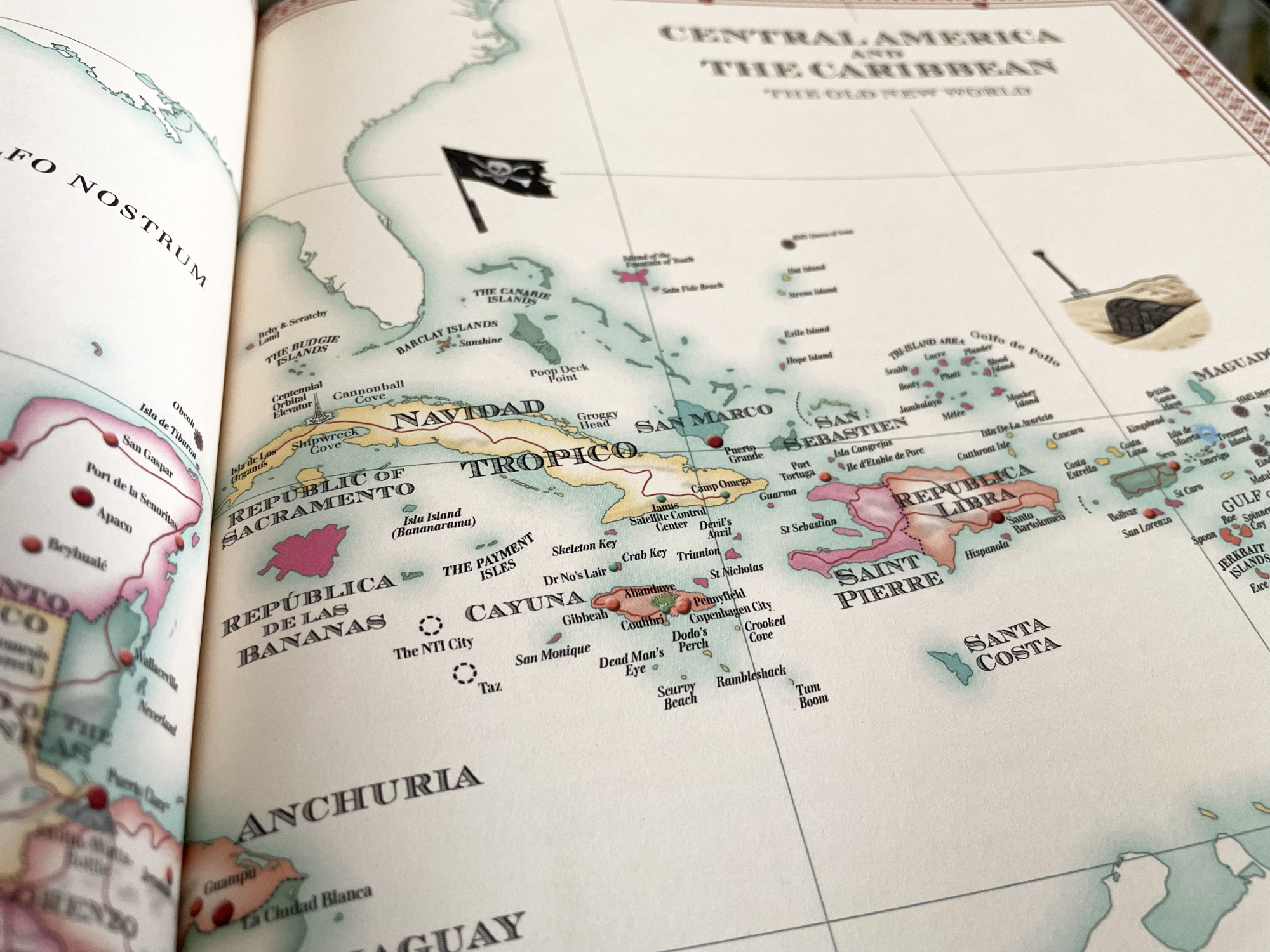
Detail from the map of Central America and the Caribbean, which features many small fictional islands alongside the real ones.
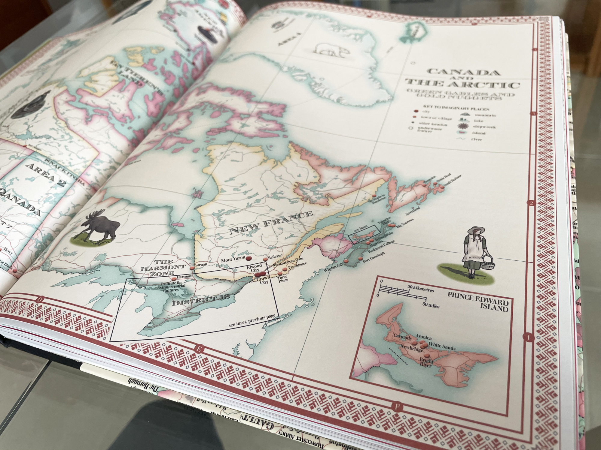
Detail from the map of Canada and the Arctic. The unusual distorted projection of this map was created by adapting a segment of an azimuthal map centred on the North Pole; this allowed me to fit in the entirety of Canada, Greenland and the Arctic comfortably across the full width of the double page spread.
One other design decision of note was to hide the graticules (lines of latitude and longitude) from each map to avoid confusion with the coordinate grid lines. However, all text labels are curved or rotated to maintain the sense of curvature in the projections.

Detail from the map of Antarctica, full of monsters and alien creatures.

A selection of my favourite illustrations from the maps. Clockwise from top left: Count Orlok from the film Nosferatu; the Child Catcher from Chitty Chitty Bang Bang; a castaway representing Robinson Crusoe; Anne Shirley from the Anne of Green Gables stories; the Brontë sisters and their brother Branwell (based on the famous group portrait) looking at a map of Gondal, their invented island in the shape of Yorkshire set in the Pacific Ocean; Hogwarts School from the Harry Potter stories; and the house and characters from the TV sitcom Father Ted.

Some more of my favourite illustrations. Clockwise from top left: Gulliver and a giant bee in Brobdingnag and with a Houyhnhnm (talking horse) from Gulliver's Travels; the Grand Budapest Hotel from the movie of the same name; Godzilla or Gojira; yellow periscopes that represent The Yellow Submarine; floating plastic waste that references the island in Plastic Beach, the album by Gorillaz; the whale attacking the crew of the Pequod in Moby-Dick; and the main characters from the classical Chinese tale Journey to the West.
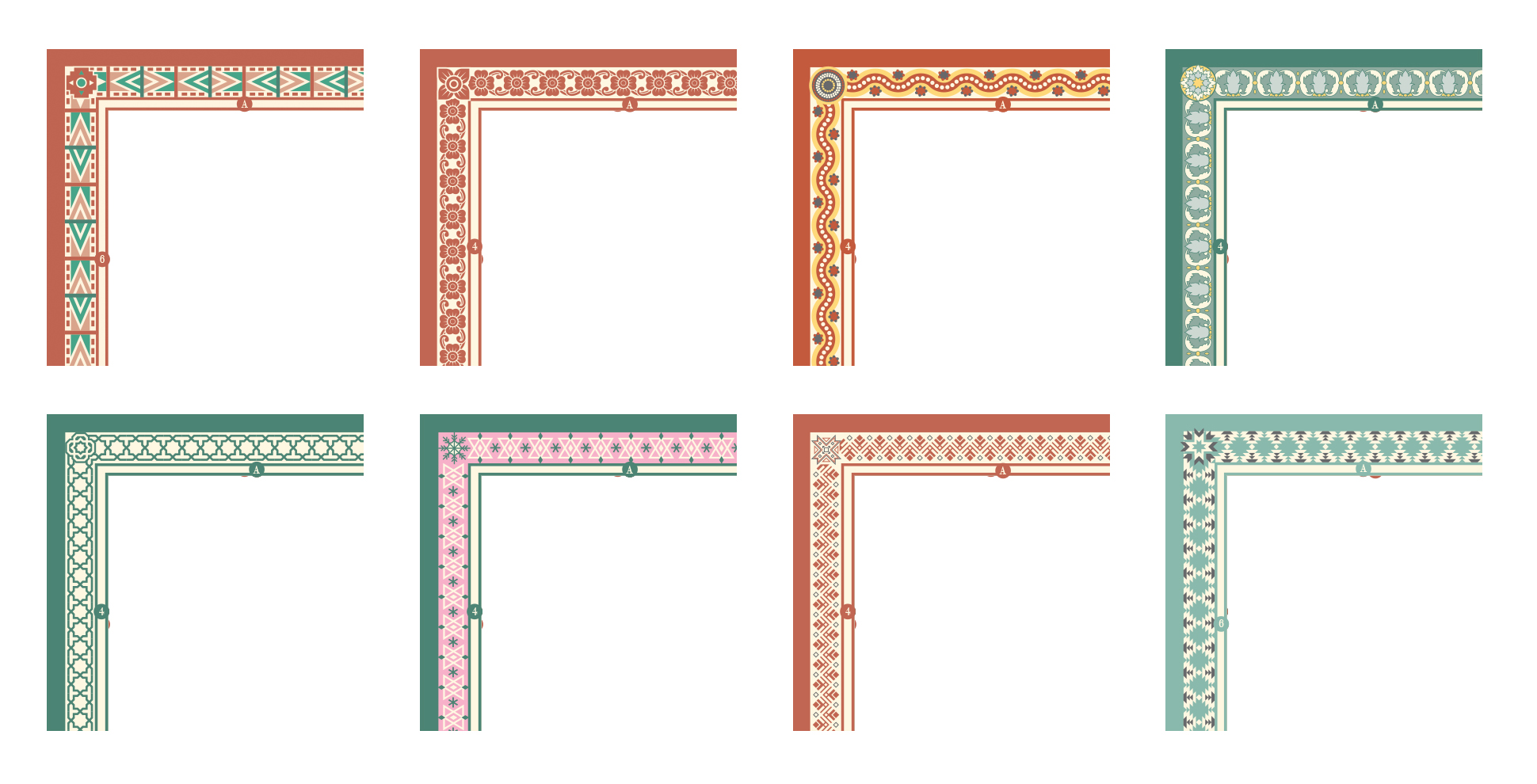
Details of some of the border patterns that decorate the maps. Each one was designed to reflect a culture or traditional designs unique to each continent or region. From the top left: Africa, south east Asia, Australia, Europe, South America, North America, the Nordic Countries, and the Middle East.