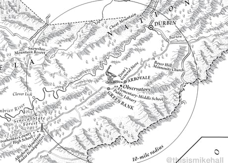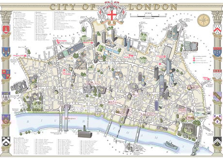
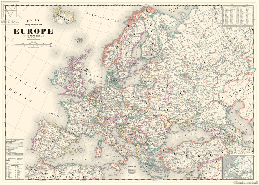
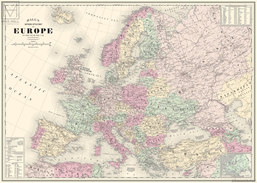
Antique-Style Map of Europe
Self-initiated project | 2017-21 | Adobe Illustrator and Photoshop
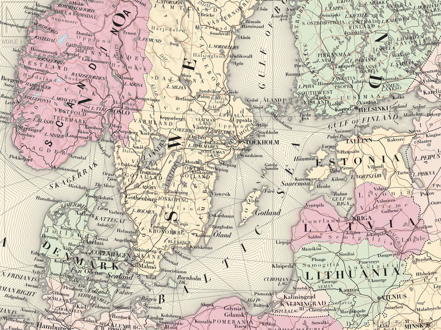
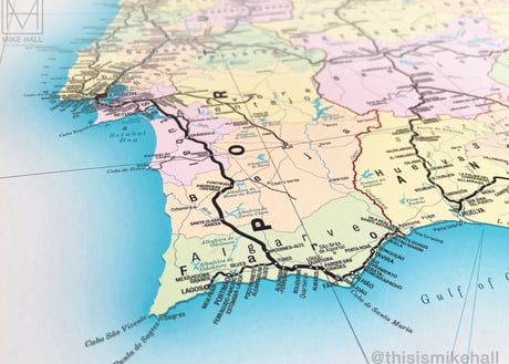
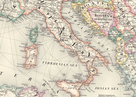
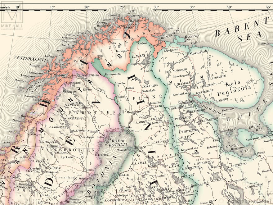
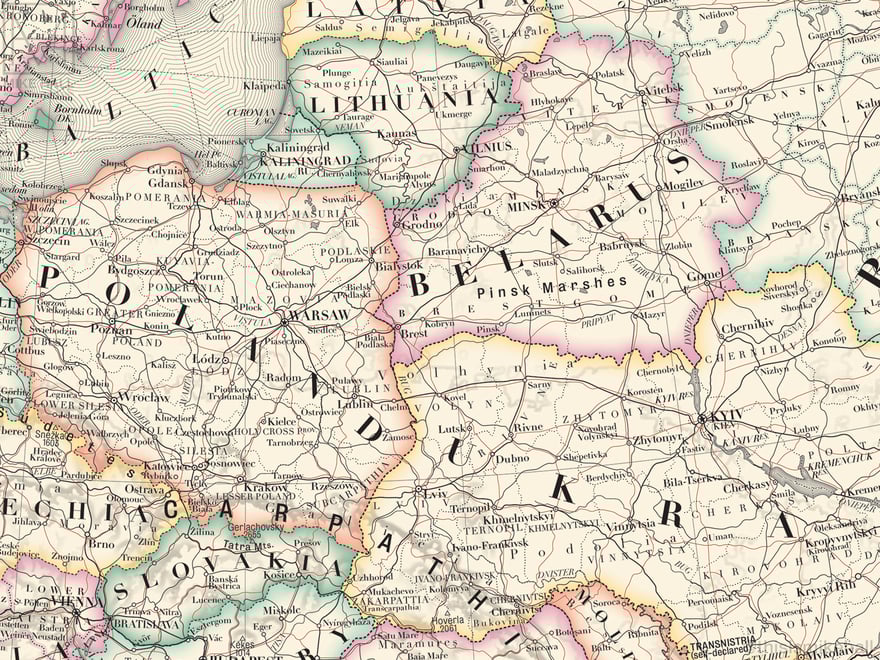
This detailed map of the entire continent of Europe continues my explorations into creating contemporary maps in antiquated styles. Featuring over 2,000 individual place names and nearly 1,000 geographical features including islands, rivers, lakes, mountain ranges, peaks, glaciers and headlands, it depicts the continent and all its present-day nation states, first-level administrative divisions, regions and disputed territories, all as of Spring 2021*. The style was developed to resemble an antique map of the mid-late 19th century, utilising a period-style decoration scheme, range of symbols and serif and sans-serif typefaces throughout; other features such as the system of concentric outlines of decreasing widths around the coastlines, the delicate colour palette consisting of five main colours with subtle fading vignette effects around each country's outline, and the light sepia background colour all enhance the impression of an antique map.
Prints of this design are available to purchase via my online store. Click the images below to enlarge.
(* The original version of this map was completed in 2018, and was modified and updated in 2021)
Click here to view the map in closer detail.
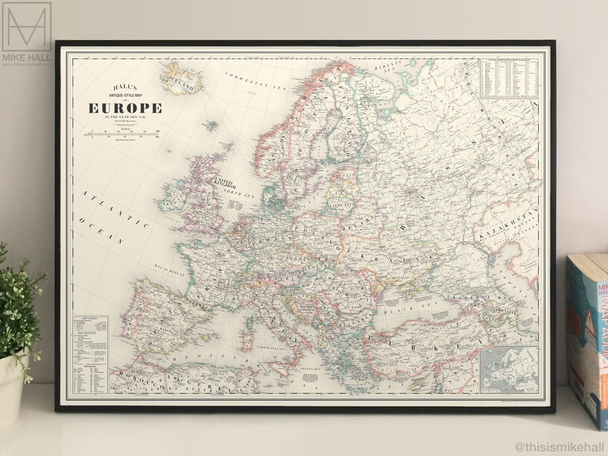
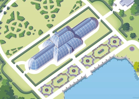
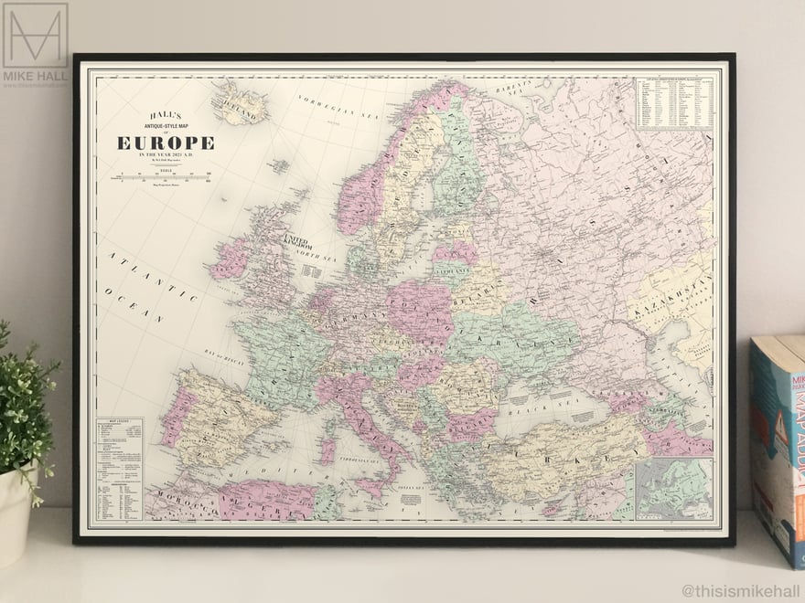
A framed 70 x 50 centimetre print of the map.
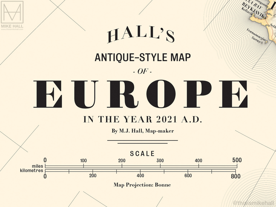
The title, with a stylised 'HALL'S' logo in homage to Bacon's Standard Map of Europe (1920).
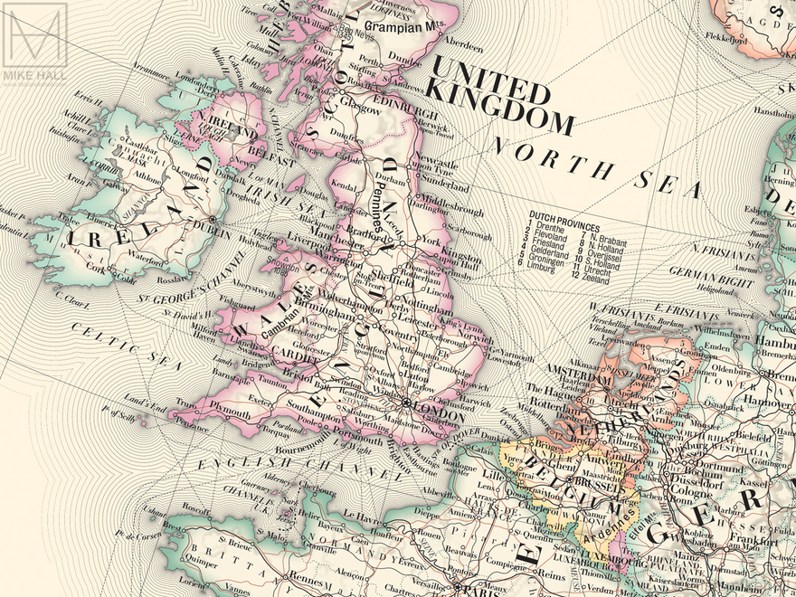
All names are written in their English exonyms, e.g. Brittany instead of the French Bretagne, Catalonia instead of the Spanish Cataluña or Catalan Catalunya, and so on.
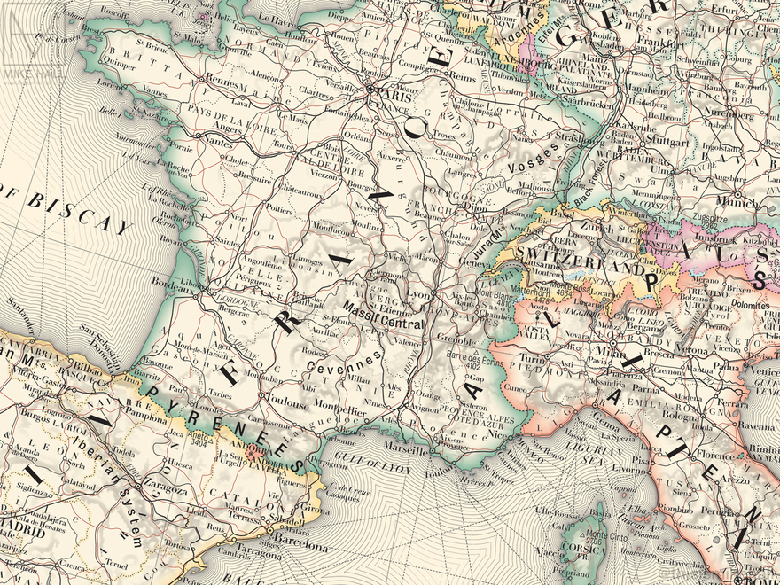
The map displays the first-level administrative divisions of most countries, including federal (Austrian and German states, Russian oblasts), autonomous (Spanish communities), provincial (Dutch and Turkish provinces) and regional (French and Italian regions, Norwegian and Swedish counties) and so on.
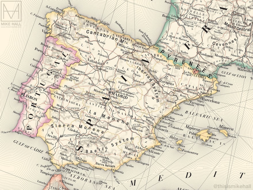
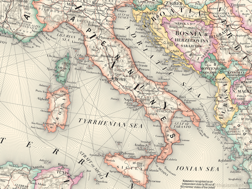
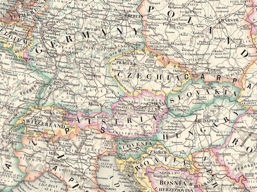
For countries that are too small to show their administrative divisions clearly, I have labelled historical and cultural regions which are generally well-known but not necessarily in official usage today. A range of text labels and border styles distinguish visually between each of these divisions.
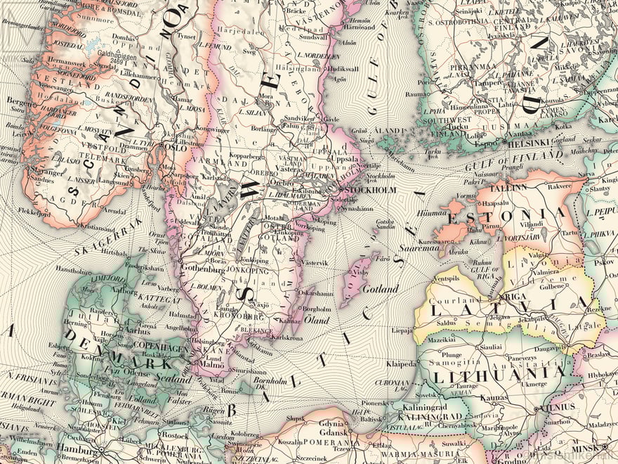
Researching the population and census data for each country allowed me to develop a system of symbols and text label sizes to represent the populations of each major city, town and settlement.
The map is finished with a simple border design, with a dashed black and white line representing lines of latitude and longitude.
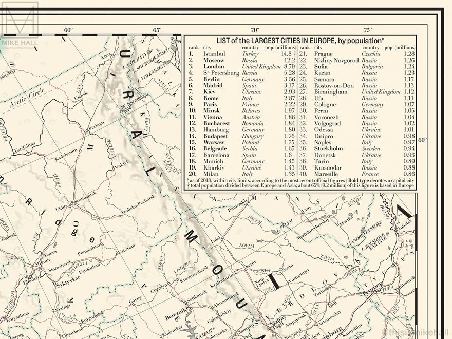
A table at the top right of the design displays a list of the forty most populous cities in Europe, as of 2018.
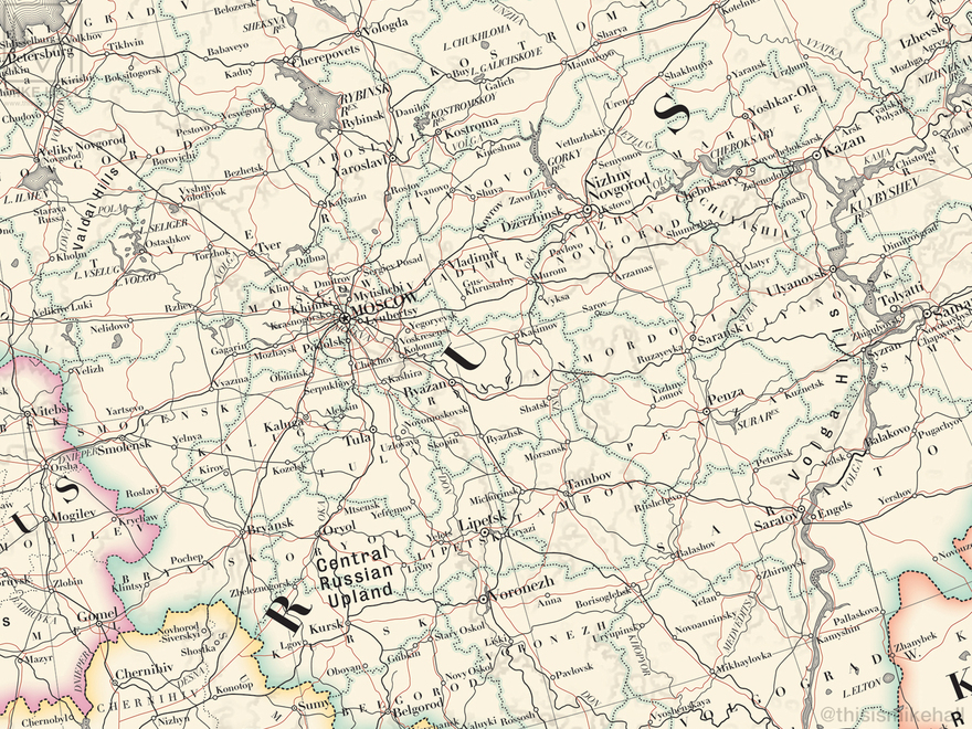
The road and rail networks are also extensively represented; major roads and highways are represented by red lines, while railways are represented by black lines (thicker for major lines, thinner for less important lines).
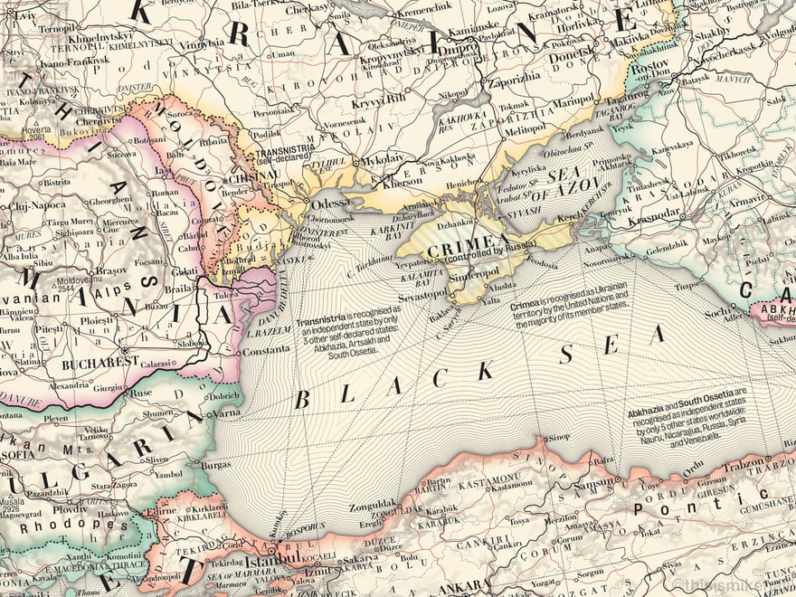
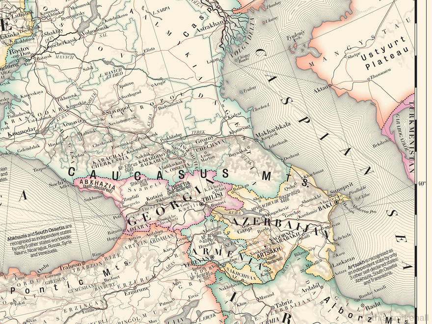
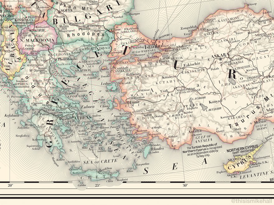
Several ongoing border and regional disputes are represented, including Kosovo, Crimea, Transnistria in Moldova, and various breakaway republics and disputes in the Caucasus region. Annotations around the map give some explanatory context for each dispute.
The map's edges break through the border neatline in certain places, a distinctive feature of antique maps.
Dashed lines represent ferry lines between ports.
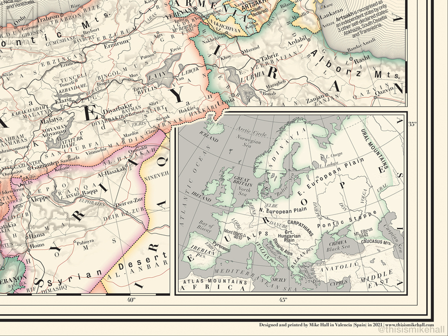
Detail of the miniature map inset at the bottom right corner, showing a summary of the continent's main geographical features.
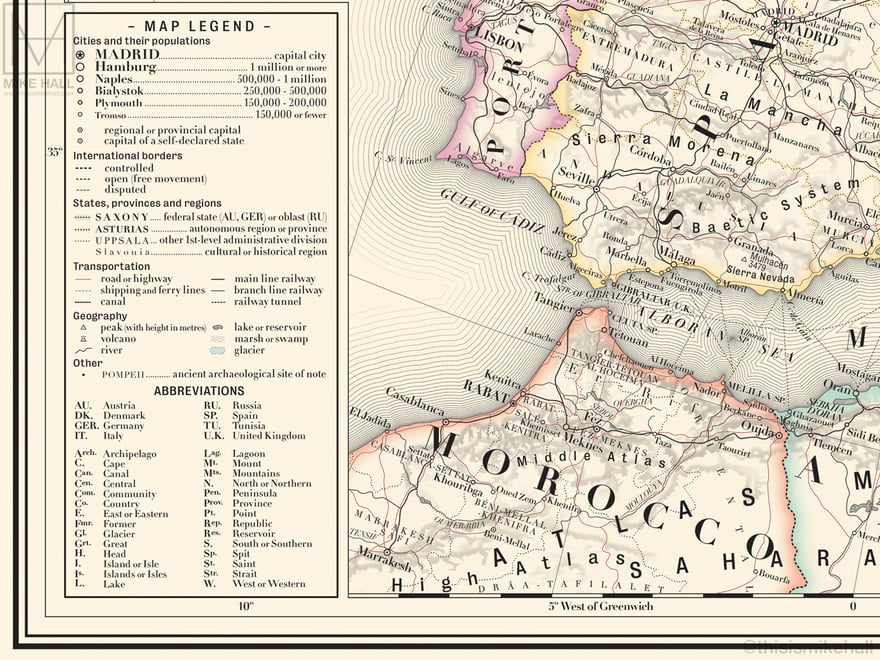
Detail of the legend box at the bottom left corner.
An alternative version of the design in four colours with solid fills. Click here to view this design in closer detail.
A framed 70 x 50 centimetre print of the four-colour version.