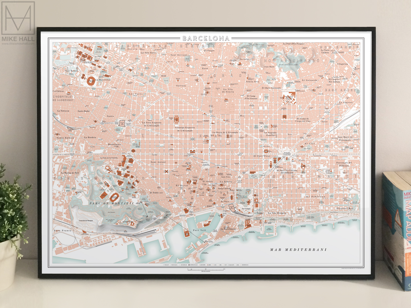
Maps of Barcelona and Valencia, Spain
Self-initiated project | 2014-18 | Adobe Illustrator
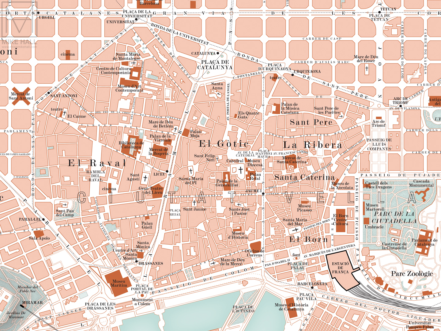
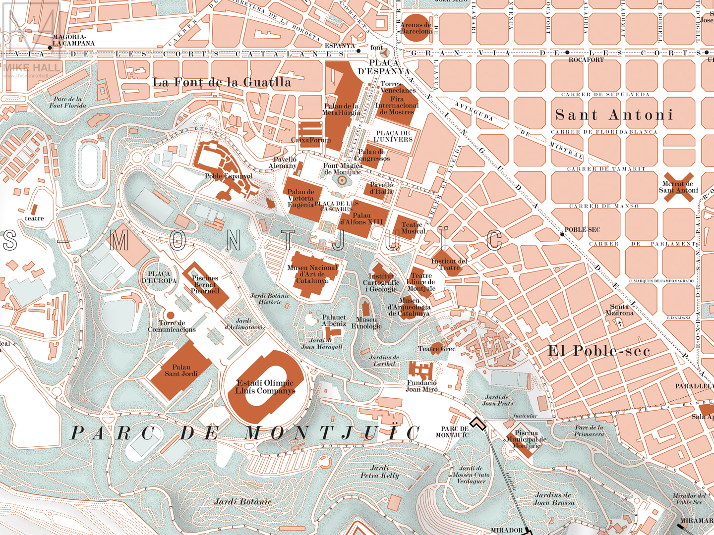
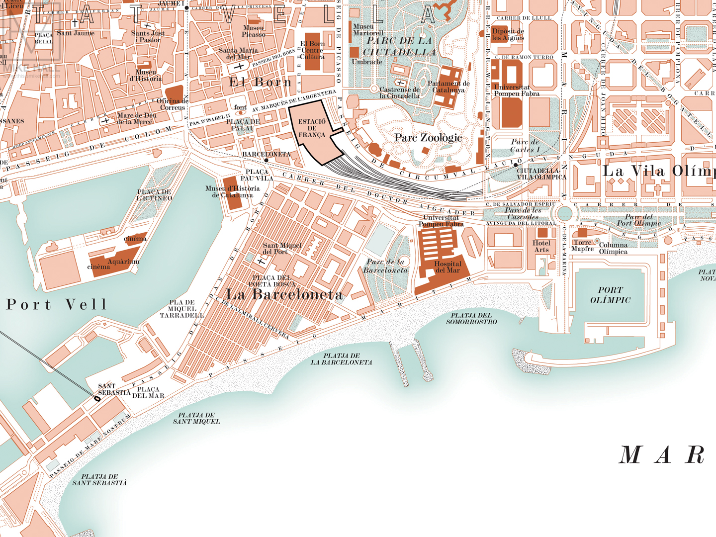
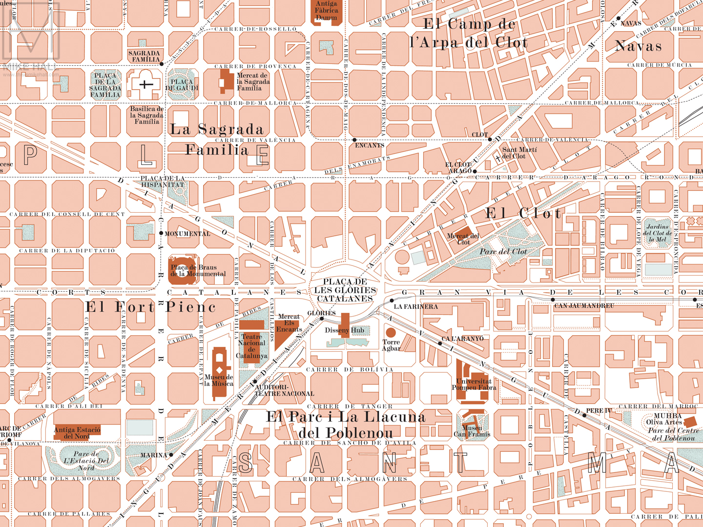
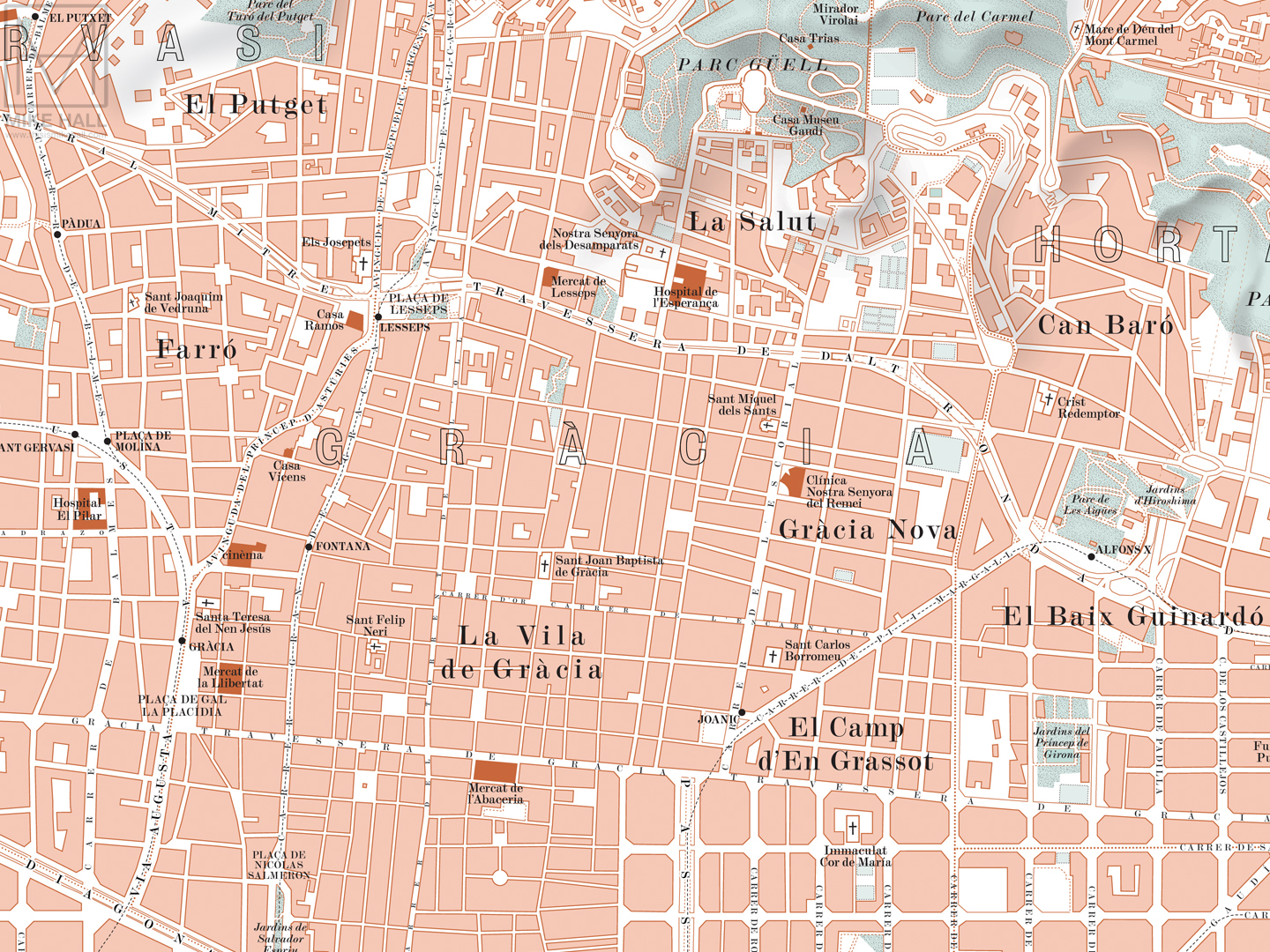
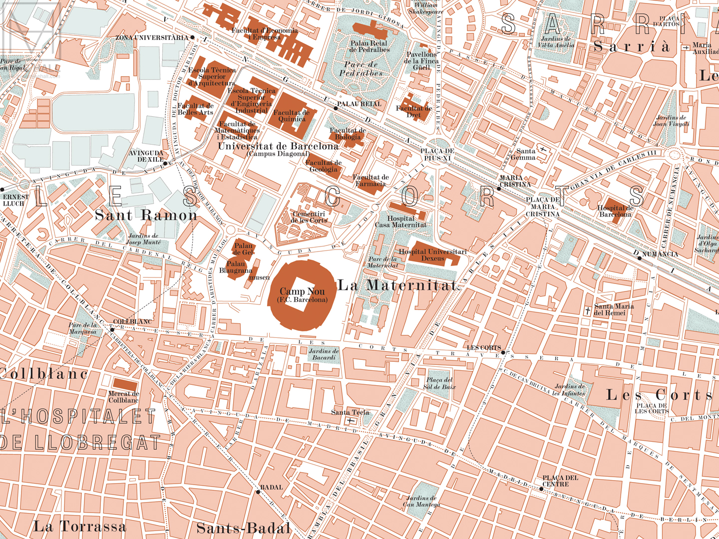
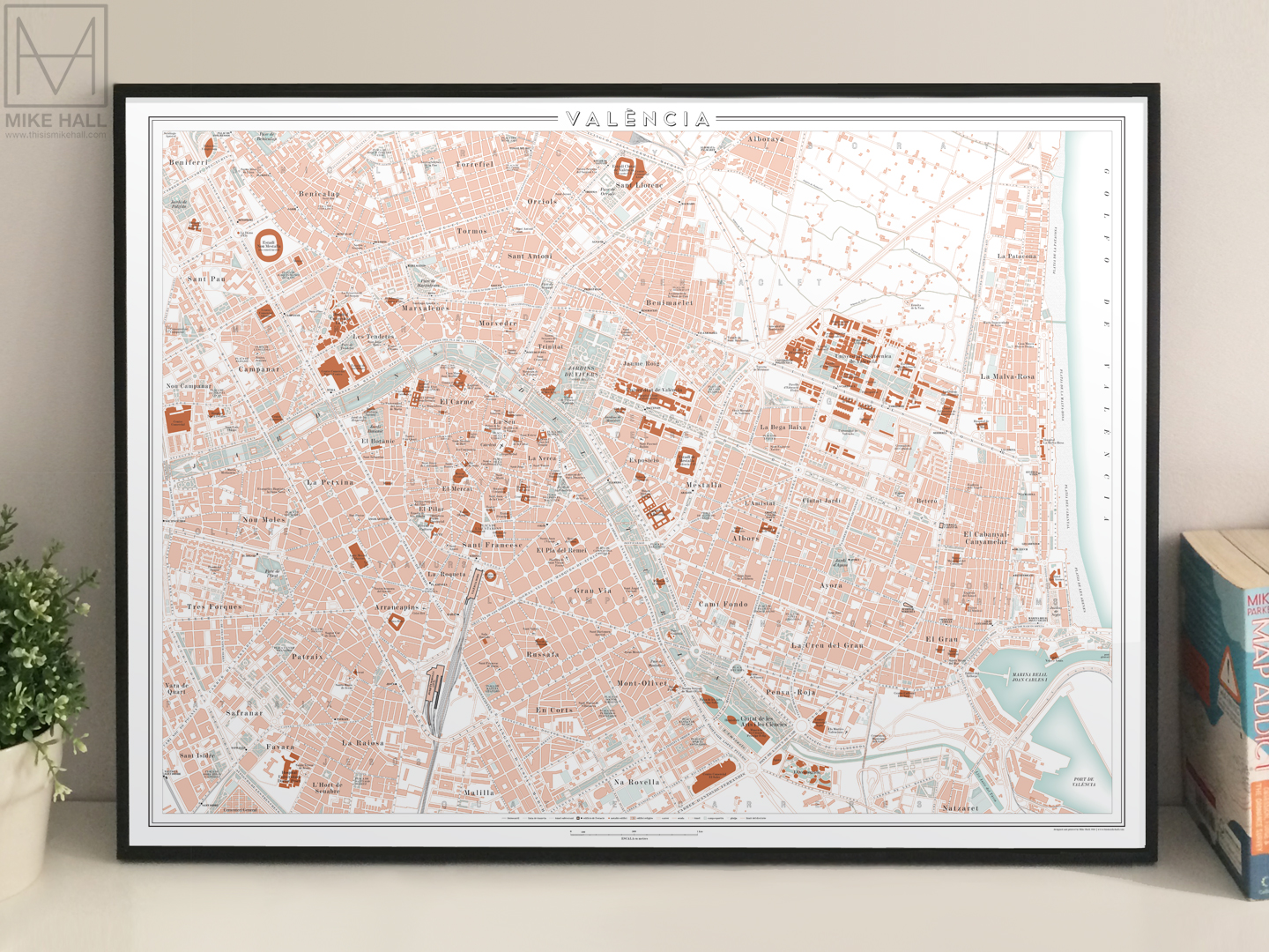
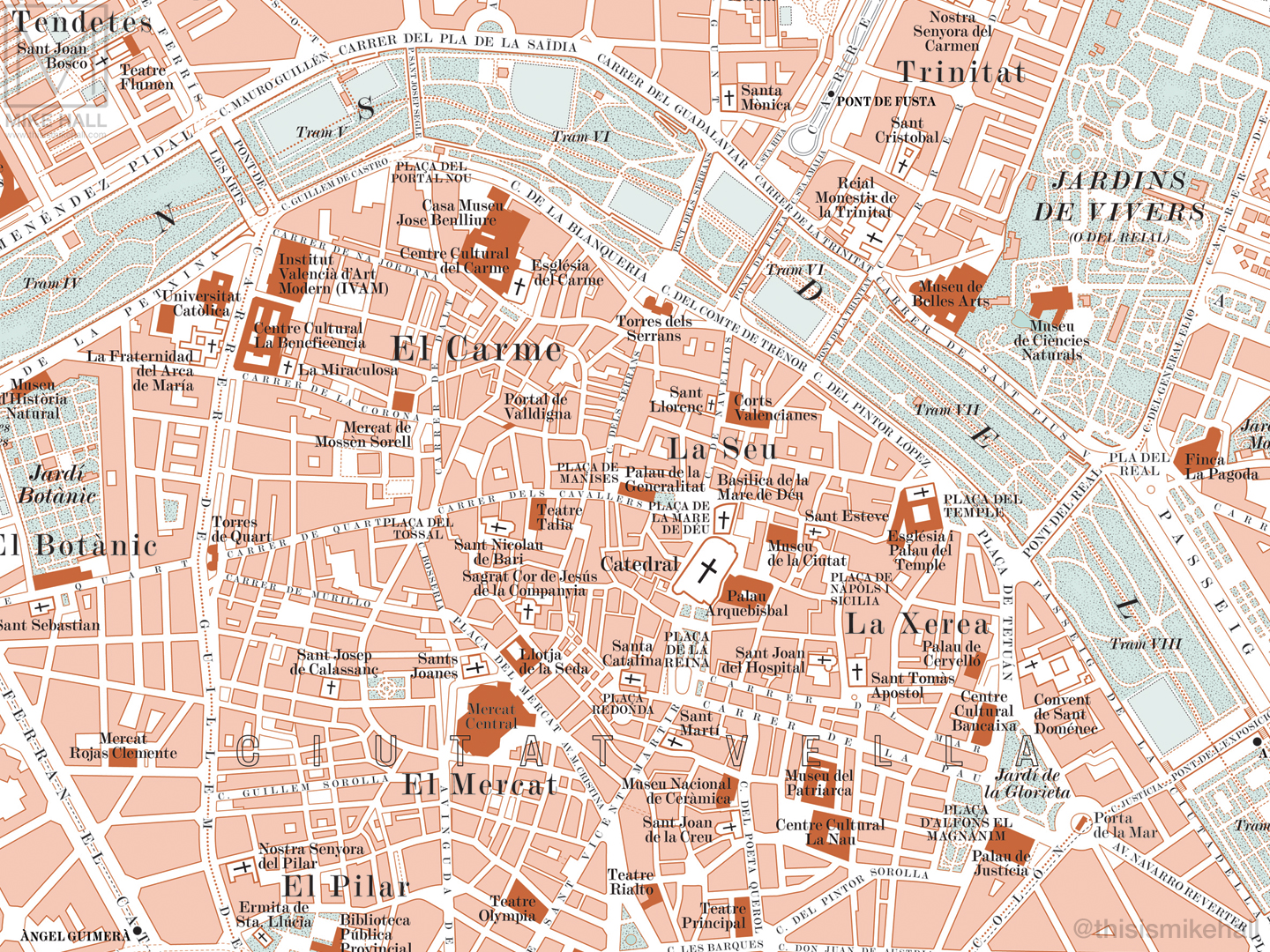
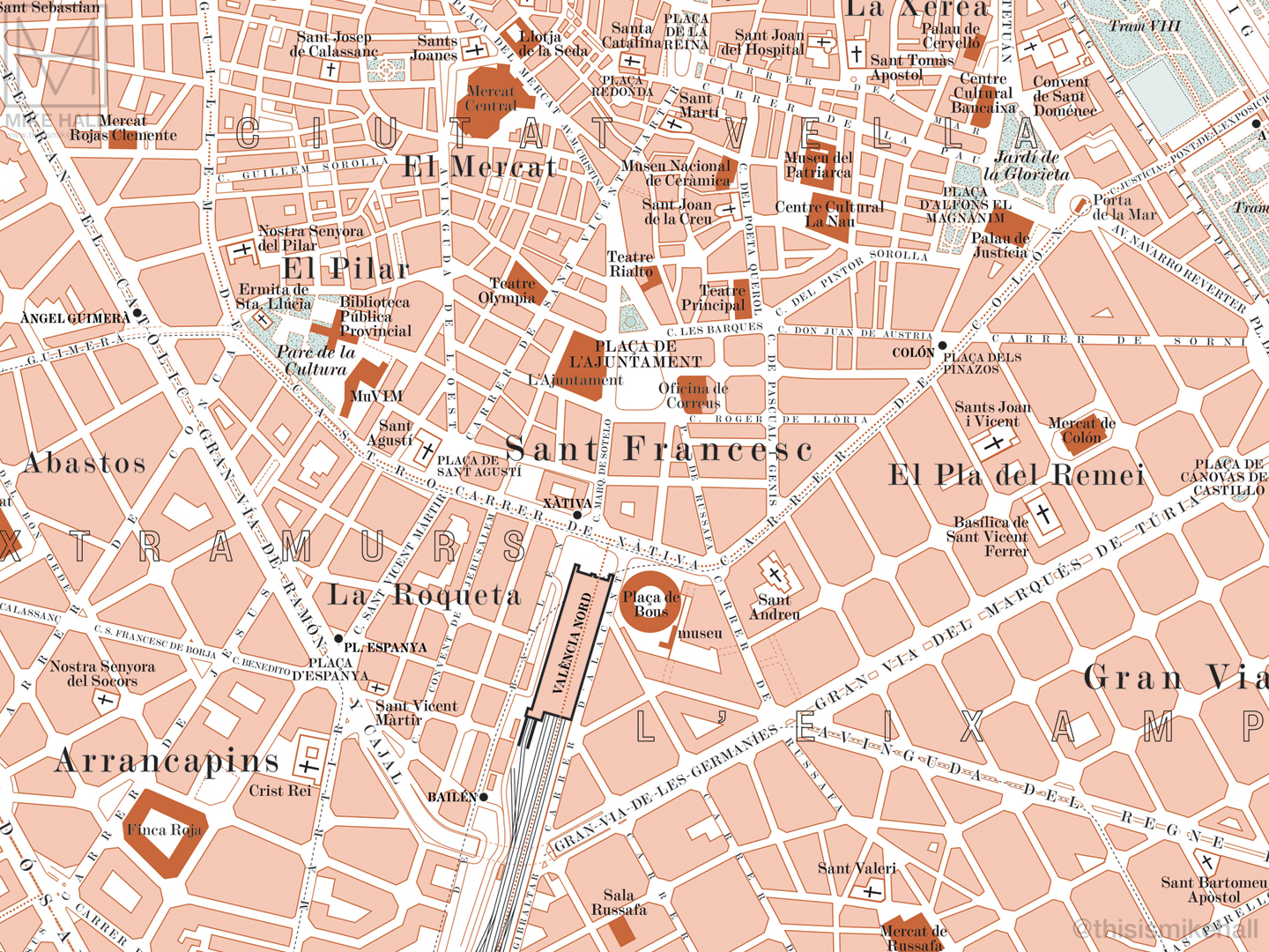
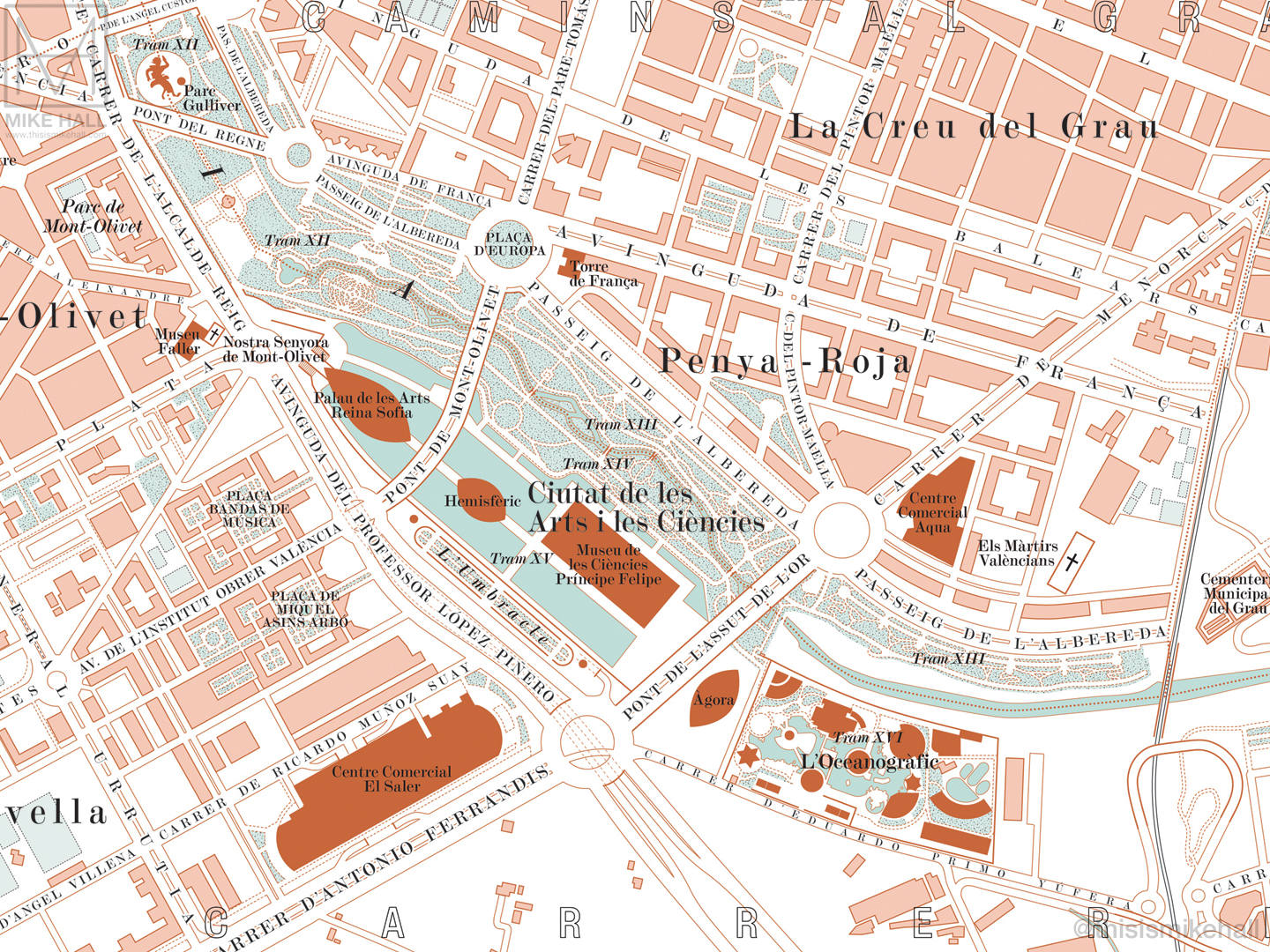
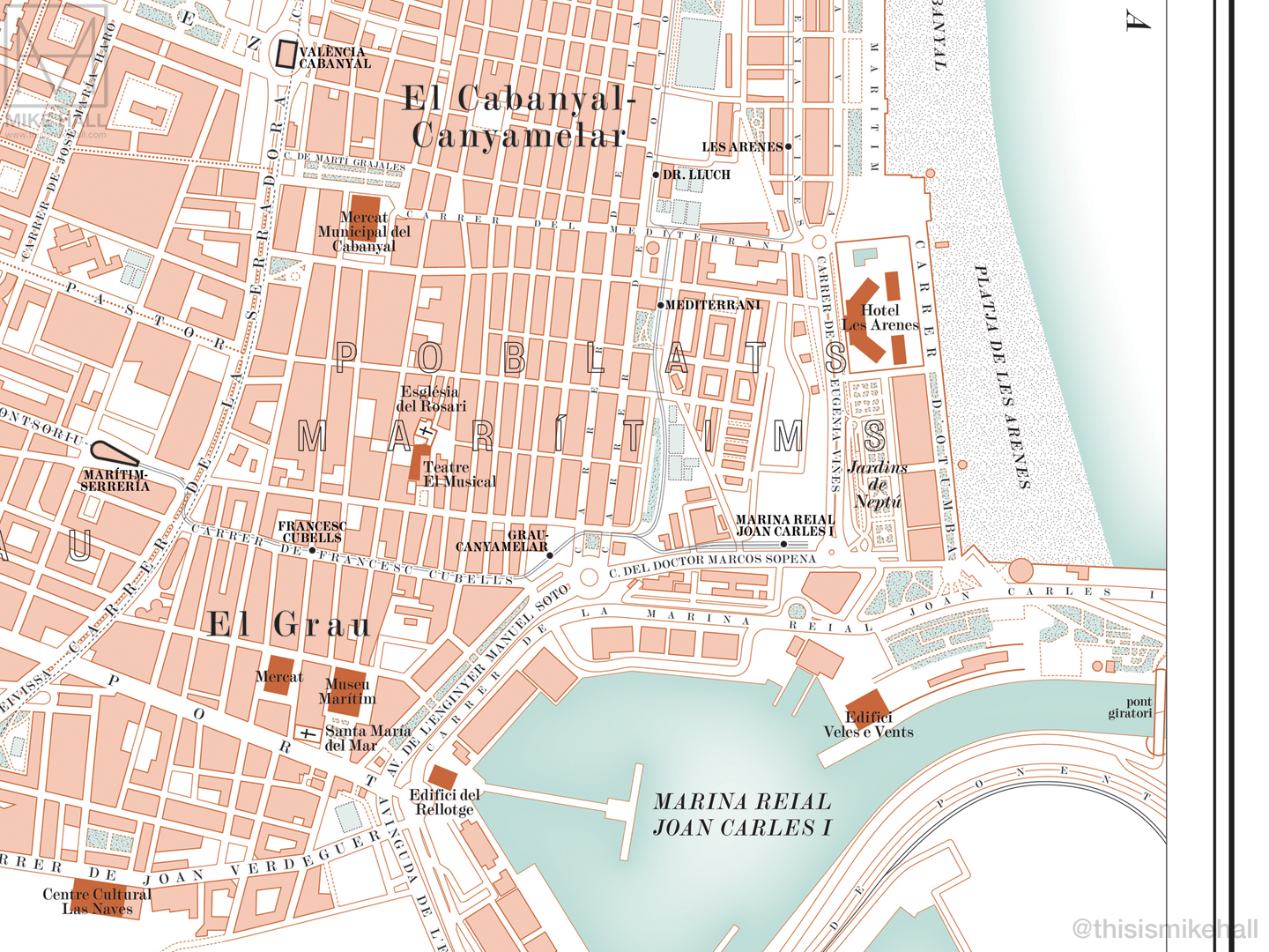
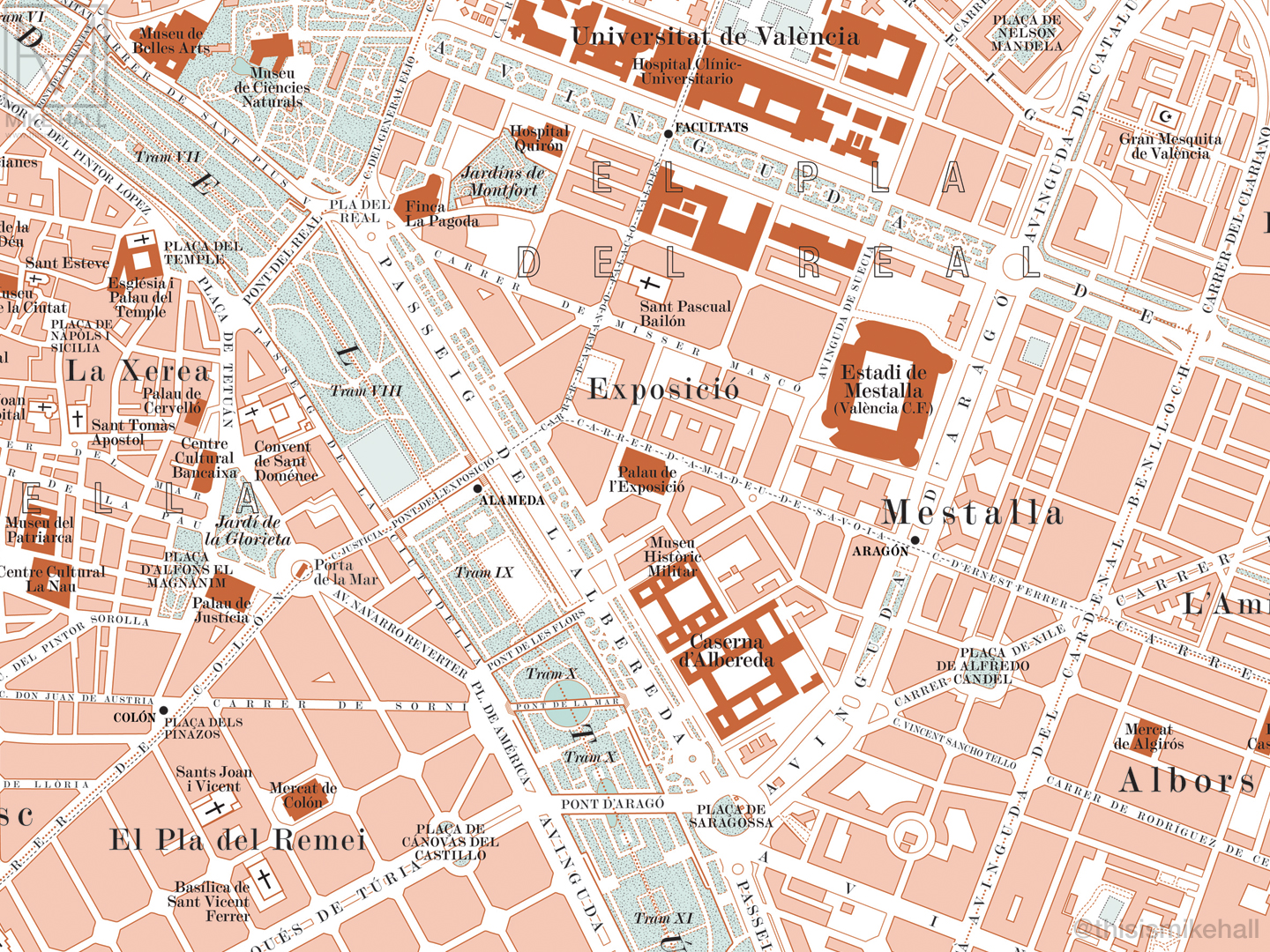
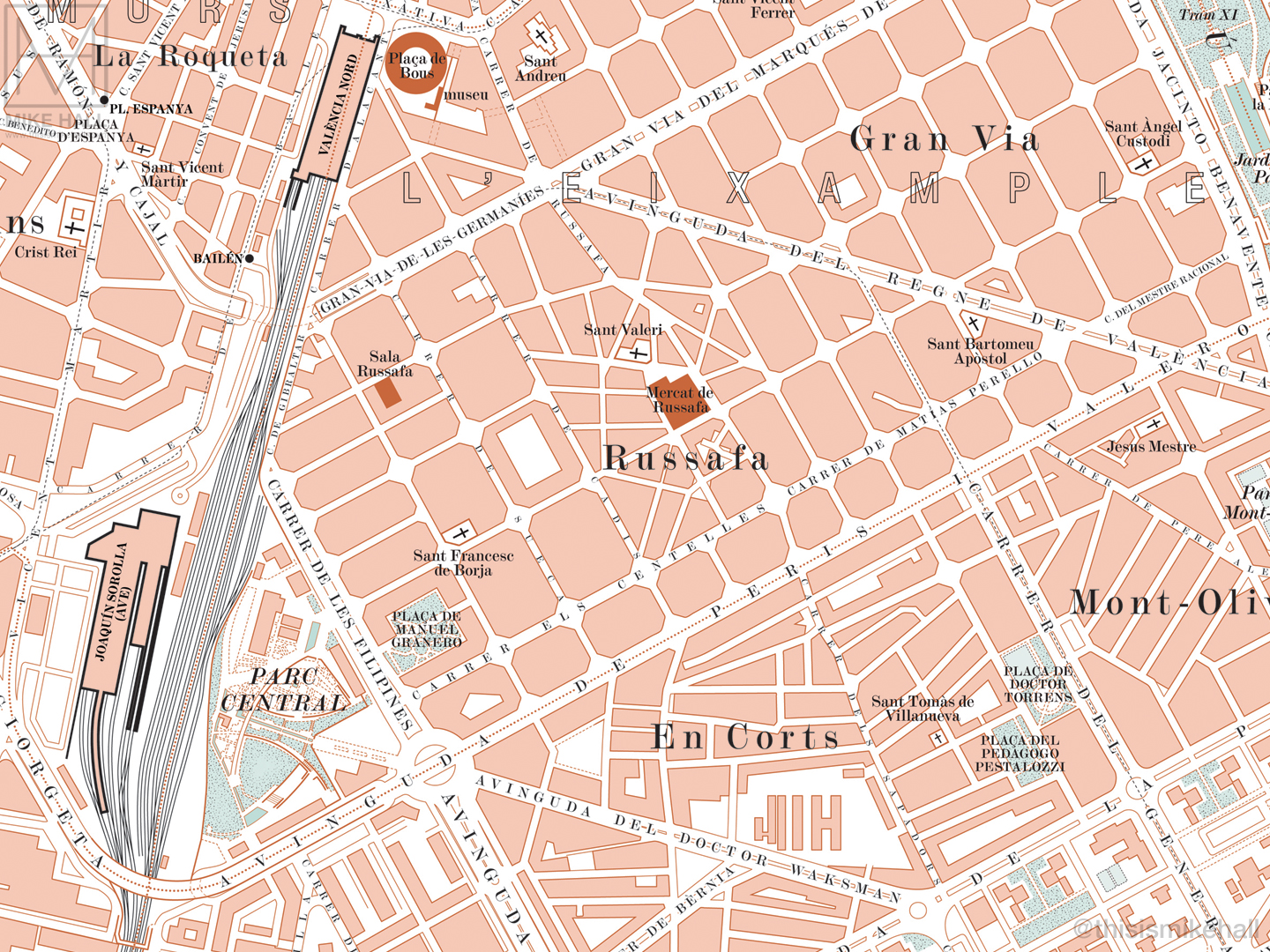
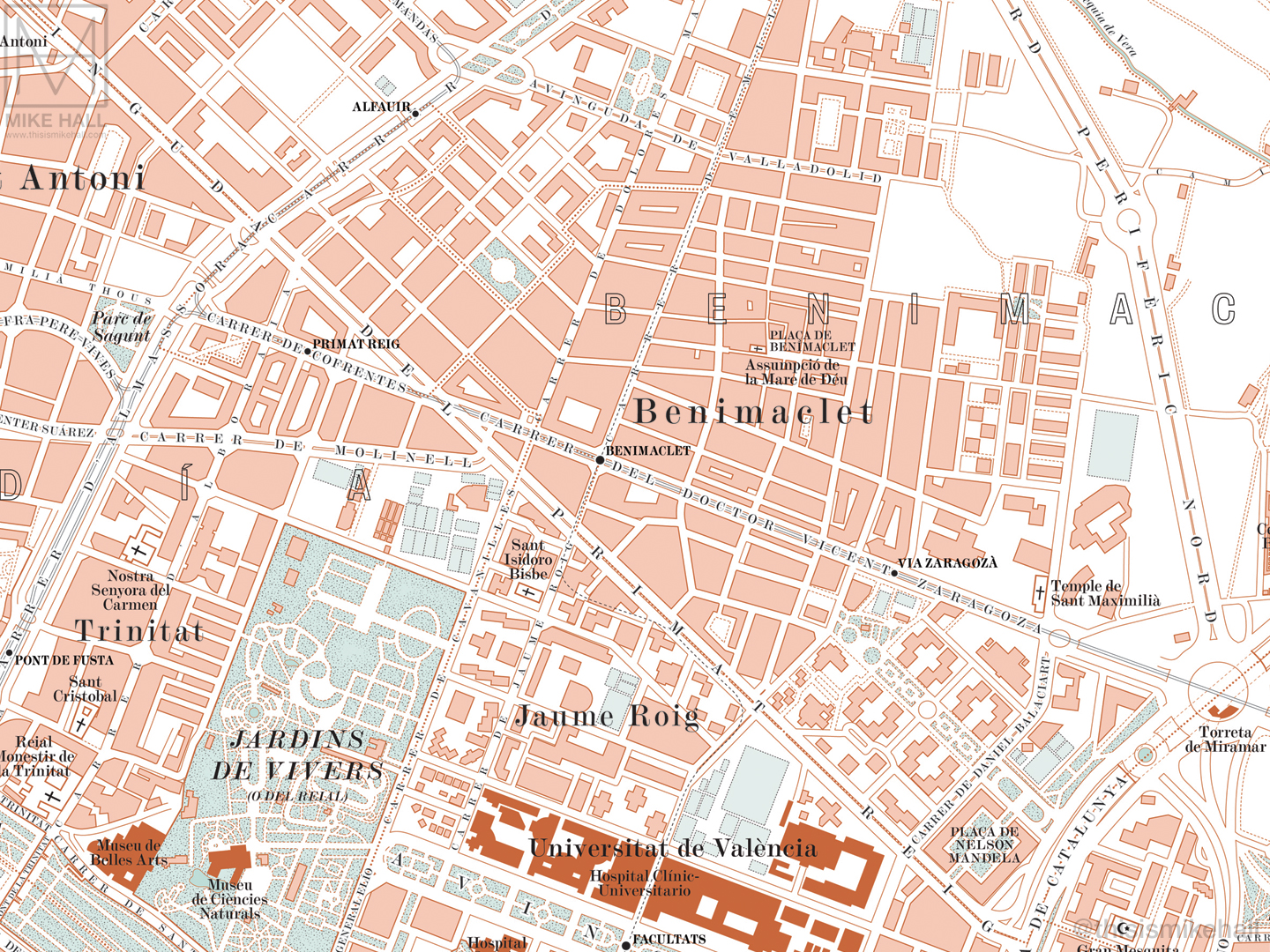
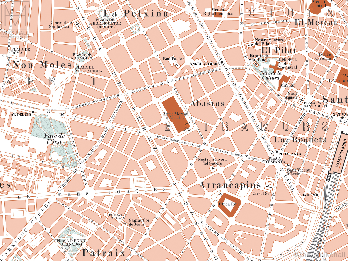
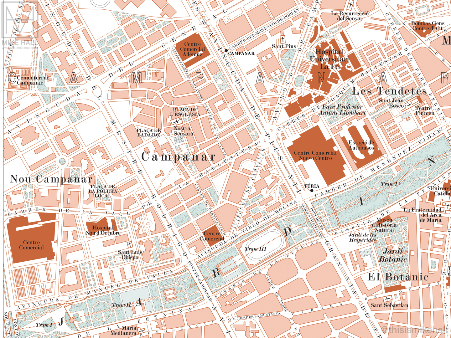
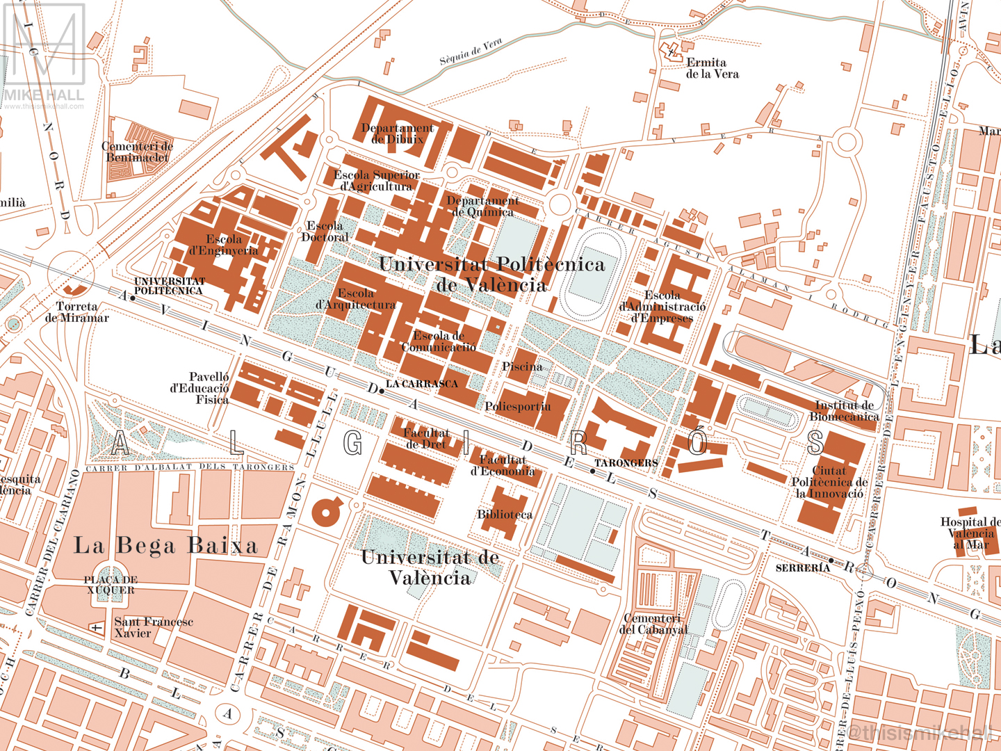
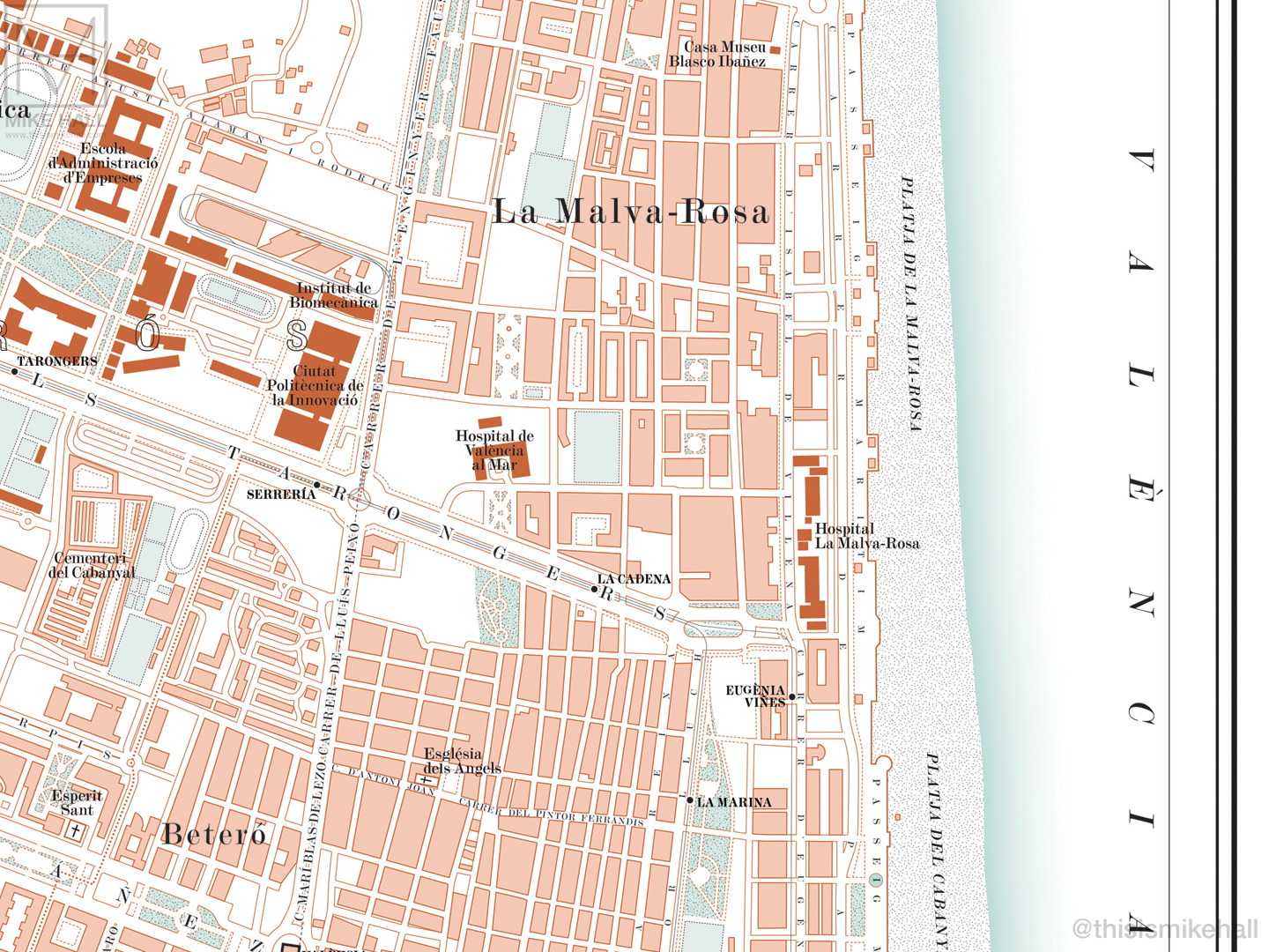
These designs for maps of Valencia (my adopted home city) and Barcelona take their inspiration from the visual style, coloration and typography of city maps that appeared in guidebooks such as Baedeker and Bradshaw's in the late 19th and early 20th centuries. Major streets and thoroughfares, railway termini, metro stations, landmarks, parks, gardens, lakes and bridges are all carefully delineated and labelled. The courses of all the various underground railways are depicted by dashed black lines. Hills and variations in the land height are picked out with subtle shading. The design is finished with a simple, elegant border and title, with a symbol key and scale bar along the bottom edge.
Prints of both designs are available to purchase via my online store.